
Book contents
- Frontmatter
- PREFACE
- EDITORIAL NOTE
- Contents
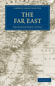
- LIST OF MAPS AND ILLUSTRATIONS
- CHAPTER I DEFINITION
- CHAPTER II THE CENTRAL KINGDOM: CHINA
- CHAPTER III THE NORTHERN BASIN. THE YELLOW RIVER
- CHAPTER IV THE MIDDLE BASIN: PART I. THE YANGTSE RIVER
- CHAPTER V THE MIDDLE BASIN: PART II. THE PROVINCE OF SZECHUAN
- CHAPTER VI THE MIDDLE BASIN: PART III. THE CHENGTU PLATEAU
- CHAPTER VII THE MIDDLE BASIN: PART IV. THE LOWER YANGTSE PROVINCES
- CHAPTER VIII THE INTERMEDIATE PROVINCES
- CHAPTER IX THE SOUTHERN BASIN. YUNNAN TO CANTON
- CHAPTER X THE DEPENDENCIES: PART I. MANCHURIA
- CHAPTER XI THE DEPENDENCIES: PART II. MONGOLIA
- CHAPTER XII THE DEPENDENCIES: PART III. TURKESTAN
- CHAPTER XIII THE DEPENDENCIES: PART IV. TIBET
- CHAPTER XIV WHILOM DEPENDENCIES: PART I. INDO-CHINA
- CHAPTER XV WHILOM DEPENDENCIES: PART II. COREA
- CHAPTER XVI THE BUFFER KINGDOM: SIAM
- CHAPTER XVII THE ISLAND EMPIRE: JAPAN
- INDEX
- Plate section
CHAPTER XV - WHILOM DEPENDENCIES: PART II. COREA
Published online by Cambridge University Press: 05 October 2010
- Frontmatter
- PREFACE
- EDITORIAL NOTE
- Contents
- LIST OF MAPS AND ILLUSTRATIONS
- CHAPTER I DEFINITION
- CHAPTER II THE CENTRAL KINGDOM: CHINA
- CHAPTER III THE NORTHERN BASIN. THE YELLOW RIVER
- CHAPTER IV THE MIDDLE BASIN: PART I. THE YANGTSE RIVER
- CHAPTER V THE MIDDLE BASIN: PART II. THE PROVINCE OF SZECHUAN
- CHAPTER VI THE MIDDLE BASIN: PART III. THE CHENGTU PLATEAU
- CHAPTER VII THE MIDDLE BASIN: PART IV. THE LOWER YANGTSE PROVINCES
- CHAPTER VIII THE INTERMEDIATE PROVINCES
- CHAPTER IX THE SOUTHERN BASIN. YUNNAN TO CANTON
- CHAPTER X THE DEPENDENCIES: PART I. MANCHURIA
- CHAPTER XI THE DEPENDENCIES: PART II. MONGOLIA
- CHAPTER XII THE DEPENDENCIES: PART III. TURKESTAN
- CHAPTER XIII THE DEPENDENCIES: PART IV. TIBET
- CHAPTER XIV WHILOM DEPENDENCIES: PART I. INDO-CHINA
- CHAPTER XV WHILOM DEPENDENCIES: PART II. COREA
- CHAPTER XVI THE BUFFER KINGDOM: SIAM
- CHAPTER XVII THE ISLAND EMPIRE: JAPAN
- INDEX
- Plate section
Summary
The analogy we have already indicated between the eastern coast of North America and that of Eastern Asia cannot fail to strike any one who studies their geography and is familiar with the climate and resources of the two regions. Either is situated on the east coast of a great continent: each is affected by a warm gulf stream, the reflux of the trade-wind driven current in the tropical regions to the south—deflected off its shores by the land-masses obstructing a continuous western flow—and thus the stream, as it starts eastwards, leaves room in both cases for the descent of a cold Arctic current between it and the coast to the north. The distinction is that on the Indo-China coast, owing to the different configuration of the land and the wider sweep of the Pacific, these phenomena take place in a lower latitude. On the coast of North America, the Gulf Stream ascends to 35° north before moving east; on the coast of China the Kuro-siwo takes its departure on the verge of the tropics. The monsoon winds, due to the larger land-mass of the Asiatic continent, that prevail off the coasts of India and China go farther to emphasize the distinction; blowing in winter steadily from the north they drive the surface cold water at that season farther south than do the more intermittent gales of the North Atlantic; river, the western half being thinly peopled by aboriginal tribes, and valuable only for its wealth in minerals ; isolated fertile valleys are found amongst the lofty mountain mass which fills this region, such as the Chien-chang valley with its chief city, Ningyuen, in the.south, and the rich valley of Yachow in the north.
- Type
- Chapter
- Information
- The Far East , pp. 243 - 257Publisher: Cambridge University PressPrint publication year: 2010