

No CrossRef data available.
Article contents
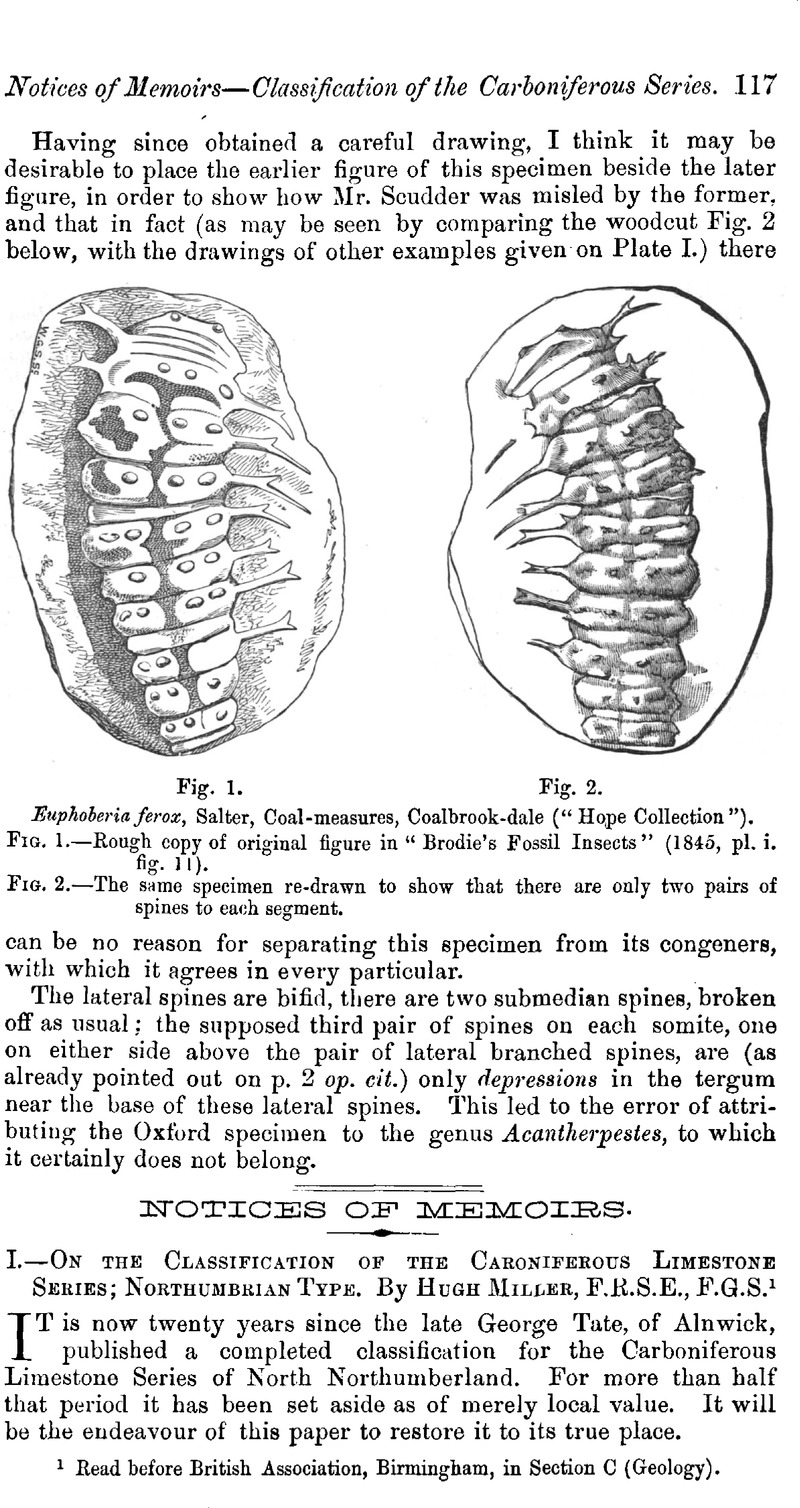
I.—On the Classification of the Caroniferous Limestone Series; Northumbrian Type
Published online by Cambridge University Press: 01 May 2009
Abstract
An abstract is not available for this content so a preview has been provided. As you have access to this content, a full PDF is available via the ‘Save PDF’ action button.
- Type
- Notices of Memoirs
- Information
- Copyright
- Copyright © Cambridge University Press 1887
References
page 119 note 1 “To the north of Berwick, the lowest accepted Bernician limestone is the Dun limestone, well known throughout the northern part of Northumberland, but only with great reserve to be correlated with a bed of the same name in the Upper North Tyne district (the Plashetts Dun Limestone of the diagram). This is the limestone which crops out for some miles along the coast at Lamberton… But in the Upper Coquet district (Mid-Northumberland), where the Tuedians are extremely well developed, no such limestone can (could) be traced, and the Harbottle Grits are so thoroughly Bernician in facies, and so well divided stratigraphically from the Tuedians, that there the base of this great sandstone series forms quite the most convenient boundary-line. Now there is little doubt that the horizon of the Lamberton or Dun Limestone is above the Harbottle Grits, so that the merely expedient and artificial character of the boundaries thus arrived at is shown at once. The truth is that no line should be drawn at all except as the merest matter of convenience.”—Lebour, Outlines of the Geology of Northumberland, p. 44. in the diagram it is of course a matter of convenience that this confessedly artificial limit should be represented by a dotted line.
 You have
Access
You have
Access