Skip to main content Accessibility help
×
Hostname: page-component-cd9895bd7-mkpzs Total loading time: 0 Render date: 2025-01-06T04:49:59.969Z Has data issue: false hasContentIssue false

References

Published online by Cambridge University Press:  05 December 2012
W. G. Rees
Affiliation:
University of Cambridge
Get access

Summary

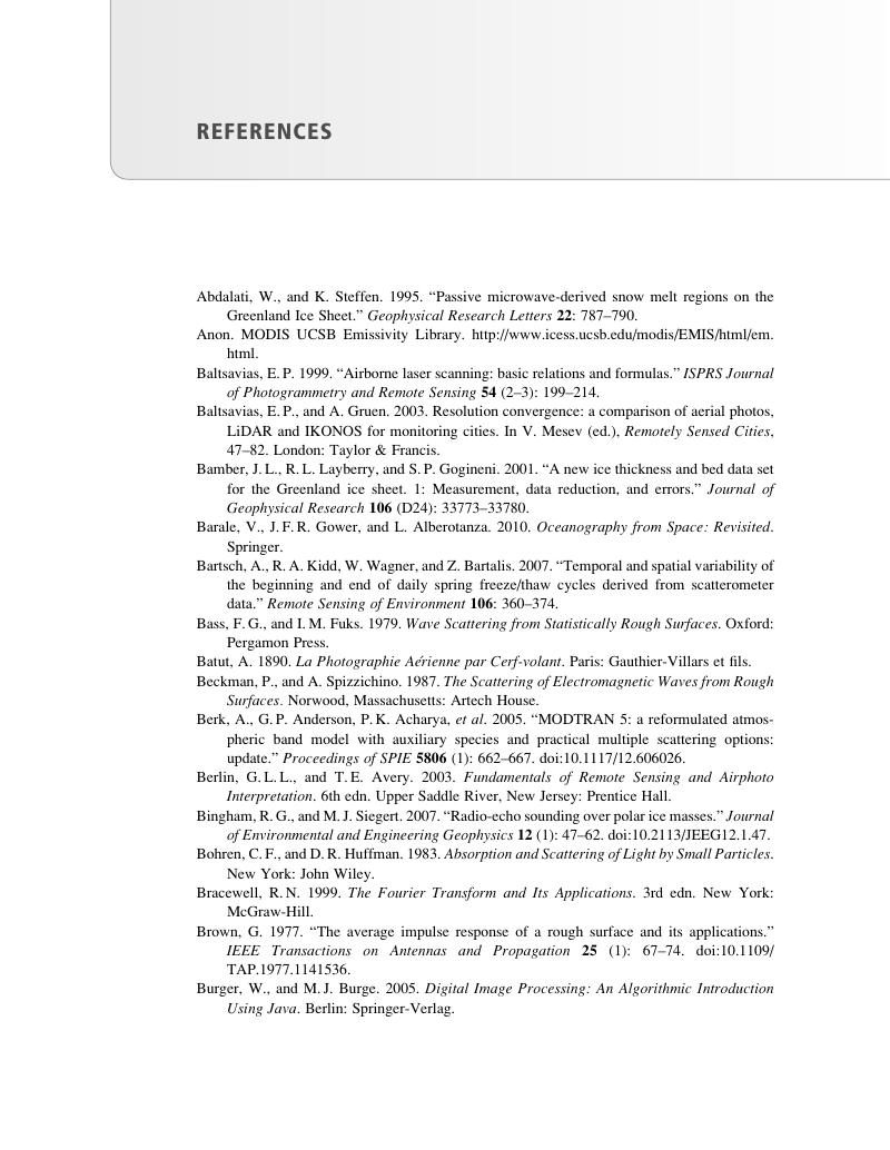
Image of the first page of this content. For PDF version, please use the ‘Save PDF’ preceeding this image.'
Type
Chapter
Information
Publisher: Cambridge University Press
Print publication year: 2012

Access options

Get access to the full version of this content by using one of the access options below. (Log in options will check for institutional or personal access. Content may require purchase if you do not have access.)

References

Abdalati, W., and Steffen, K.. 1995. “Passive microwave-derived snow melt regions on the Greenland Ice Sheet.”Geophysical Research Letters 22: 787–790.CrossRefGoogle Scholar
Anon, . MODIS UCSB Emissivity Library. .
Baltsavias, E. P. 1999. “Airborne laser scanning: basic relations and formulas.”ISPRS Journal of Photogrammetry and Remote Sensing 54 (2–3): 199–214.CrossRefGoogle Scholar
Baltsavias, E. P., and Gruen, A.. 2003. Resolution convergence: a comparison of aerial photos, LiDAR and IKONOS for monitoring cities. In Mesev, V. (ed.), Remotely Sensed Cities, 47–82. London: Taylor & Francis.Google Scholar
Bamber, J. L., Layberry, R. L., and Gogineni, S. P.. 2001. “A new ice thickness and bed data set for the Greenland ice sheet. 1: Measurement, data reduction, and errors.”Journal of Geophysical Research 106 (D24): 33773–33780.CrossRefGoogle Scholar
Barale, V., Gower, J. F. R., and Alberotanza, L.. 2010. Oceanography from Space: Revisited. Springer.CrossRefGoogle Scholar
Bartsch, A., Kidd, R. A., Wagner, W., and Bartalis, Z.. 2007. “Temporal and spatial variability of the beginning and end of daily spring freeze/thaw cycles derived from scatterometer data.”Remote Sensing of Environment 106: 360–374.CrossRefGoogle Scholar
Bass, F. G., and Fuks, I. M.. 1979. Wave Scattering from Statistically Rough Surfaces. Oxford: Pergamon Press.Google Scholar
Batut, A. 1890. La Photographie Aérienne par Cerf-volant. Paris: Gauthier-Villars et fils.Google Scholar
Beckman, P., and Spizzichino, A.. 1987. The Scattering of Electromagnetic Waves from Rough Surfaces. Norwood, Massachusetts: Artech House.Google Scholar
Berk, A., Anderson, G. P., Acharya, P. K., et al. 2005. “MODTRAN 5: a reformulated atmospheric band model with auxiliary species and practical multiple scattering options: update.”Proceedings of SPIE 5806 (1): 662–667. .CrossRefGoogle Scholar
Berlin, G. L. L., and Avery, T. E.. 2003. Fundamentals of Remote Sensing and Airphoto Interpretation. 6th edn. Upper Saddle River, New Jersey: Prentice Hall.Google Scholar
Bingham, R. G., and Siegert, M. J.. 2007. “Radio-echo sounding over polar ice masses.”Journal of Environmental and Engineering Geophysics 12 (1): 47–62. .CrossRefGoogle Scholar
Bohren, C. F., and Huffman, D. R.. 1983. Absorption and Scattering of Light by Small Particles. New York: John Wiley.Google Scholar
Bracewell, R. N. 1999. The Fourier Transform and Its Applications. 3rd edn. New York: McGraw-Hill.Google Scholar
Brown, G. 1977. “The average impulse response of a rough surface and its applications.”IEEE Transactions on Antennas and Propagation 25 (1): 67–74. .CrossRefGoogle Scholar
Burger, W., and Burge, M. J.. 2005. Digital Image Processing: An Algorithmic Introduction Using Java. Berlin: Springer-Verlag.Google Scholar
Burns, R. W. 2000. John Logie Baird: TV Pioneer. London: The Institution of Engineering and Technology.CrossRefGoogle Scholar
Campbell, J. B. 2008. Introduction to Remote Sensing. 4th edn. New York: Guilford Press.Google Scholar
Carsey, F. D. 1992. Microwave Remote Sensing of Sea Ice. Washington, DC: American Geophysical Union.CrossRefGoogle Scholar
Chahine, M. T., Chen, L., Dimotakis, P., et al. 2008. “Satellite remote sounding of mid-tropospheric CO2.”Geophysical Research Letters 35 (17): L17807.CrossRefGoogle Scholar
Chander, G., Xiong, X., Choi, T., and Angal, A.. 2010. “Monitoring on-orbit calibration stability of the Terra MODIS and Landsat 7 ETM+ sensors using pseudo-invariant test sites.”Remote Sensing of Environment 114 (4): 925–939. .CrossRefGoogle Scholar
Charalambos, P., and Suya, Y.. 2010. “Delineation and geometric modeling of road networks.”ISPRS Journal of Photogrammetry and Remote Sensing 65 (2): 165–181. .Google Scholar
Chase, A., Chase, D. Z, Weishampel, J. F, et al. 2011. “Airborne LiDAR, archaeology, and the ancient Maya landscape at caracol, Belize.”Journal of Archaeological Science 38 (2): 387–398.CrossRefGoogle Scholar
Chavez, P. S. 1988. “An improved dark-object subtraction technique for atmospheric scattering correction of multispectral data.”Remote Sensing of Environment 24 (3): 459–479. .CrossRefGoogle Scholar
Cohen, J. 1960. “A coefficient of agreement for nominal scales.”Educational and Psychological Measurement 20: 37–40.CrossRefGoogle Scholar
Cohen, W. B., and Goward, S. N.. 2004. “Landsat’s role in ecological applications of remote sensing.”BioScience 54 (6): 535–545. .CrossRefGoogle Scholar
Comiso, J. C. 2009. “Enhanced sea ice concentrations and ice extents from AMSR-E data.”Journal of the Remote Sensing Society of Japan 29 (1): 199–215.Google Scholar
Cortes, C., and Vapnik, V.. 1995. “Support-vector networks.”Machine Learning 20 (3): 273–297.CrossRefGoogle Scholar
Crosetto, M., Monserrat, O., Cuevas, M., and Crippa, B.. 2011. “Spaceborne differential SAR interferometry: data analysis tools for deformation measurement.”Remote Sensing 3 (2): 305–318. .CrossRefGoogle Scholar
Dong, S., and Huang, L.. 2011. Mapping surface displacement based on D-InSAR technique. In 2011 International Conference on Remote Sensing, Environment and Transportation Engineering (RSETE), 3259–3262. IEEE. .
Donlon, C. J., Minnett, P. J., Gentemann, C., et al. 2002. “Toward improved validation of satellite sea surface skin temperature measurements for climate research.”Journal of Climate 15 (4): 353–369. .2.0.CO;2>CrossRefGoogle Scholar
Dozier, J. 1989. “Spectral signature of Alpine snow cover from the Landsat Thematic Mapper.”Remote Sensing of Environment 28: 9–22.CrossRefGoogle Scholar
Drinkwater, M. R., Long, D. G., and Bingham, A. W.. 2001. “Greenland snow accumulation estimates from satellite radar scatterometer data.”Journal of Geophysical Research 106: 33935–33950.CrossRefGoogle Scholar
Duda, R. O., and Hart, P. E.. 1973. Pattern Recognition and Scene Analysis. New York: Wiley.Google Scholar
Elachi, C., and van Zyl, J.. 2006. Introduction to the Physics and Techniques of Remote Sensing. 2nd edn. Hoboken, New Jersey: Wiley-Interscience.CrossRefGoogle Scholar
Eppler, D. T., Farmer, L. D, Lohanick, A. W, et al. 1992. Passive microwave signatures of sea ice. In Carsey, F. D (ed.), Microwave Remote Sensing of Sea Ice, 47–71. Washington, DC: American Geophysical Union.CrossRefGoogle Scholar
Espindola, G. M., Camara, G., Reis, I. A., Bins, L. S., and Monteiro, A. M.. 2006. “Parameter selection for region-growing image segmentation algorithms using spatial autocorrelation.”International Journal of Remote Sensing 27 (14): 3035–3040. .CrossRefGoogle Scholar
Fan, K., Huang, W., Lin, H., et al. 2011. “Shallow water depth retrieval from space-borne SAR imagery.”Journal of Oceanography 67 (4): 405–413.CrossRefGoogle Scholar
Farr, T. G., Rosen, P. A., Caro, E., et al. 2007. “The Shuttle Radar Topography Mission.”Reviews of Geophysics 45: RG2004. .CrossRefGoogle Scholar
Feynman, R. P., Leighton, R. B., and Sands, M.. 2005. The Feynman Lectures on Physics. 2nd edn. 3 vols. Reading, Massachusetts:Addison-Wesley.Google Scholar
Flood, M. 2001. “Laser altimetry: from science to commercial LiDAR mapping.”Photogrammetric Engineering and Remote Sensing 67 (11): 1209–1217.Google Scholar
Flynn, L. E., McNamara, D., Beck, C. T., et al. 2009. “Measurements and products from the Solar Backscatter Ultraviolet (SBUV/2) and Ozone Mapping and Profiler Suite (OMPS) instruments.”International Journal of Remote Sensing 30 (15–16): 4259–4272. .CrossRefGoogle Scholar
Foody, G. M. 2002. “Status of land cover classification accuracy assessment.”Remote Sensing of Environment 80: 185–201.CrossRefGoogle Scholar
Forshaw, M. R. B., Haskell, A., Miller, P. F., Stanley, D. J., and Townshend, J. R. G.. 1983. “Spatial resolution of remotely sensed images.”International Journal of Remote Sensing 4 (3): 497–520.CrossRefGoogle Scholar
Frison, P. L., and Mougin, E.. 1996. “Monitoring global vegetation dynamics with ERS-1 wind scatterometer data.”International Journal of Remote Sensing 17: 3201–3218.CrossRefGoogle Scholar
Fu, L.-L. 2010. Determining ocean circulation and sea level from satellite altimetry: progress and challenges. In Barale, V., Gower, J. F. R., and Alberotanza, L. (eds.). Oceanography from Space: Revisited, 147–164. Springer.CrossRefGoogle Scholar
Gao, B. 1996. “NDWI – a normalized difference water index for remote sensing of vegetation liquid water from space.”Remote Sensing of Environment 58 (3): 257–266.CrossRefGoogle Scholar
Gao, J. 2009. “Bathymetric mapping by means of remote sensing: methods, accuracy and limitations.”Progress in Physical Geography 33 (1): 103–116. .CrossRefGoogle Scholar
Gens, R., and van Genderen, J. L.. 1996. “Review article: SAR interferometry – issues, techniques, applications.”International Journal of Remote Sensing 17 (10): 1803–1835. .CrossRefGoogle Scholar
Goetz, A. F. H. 1979. Preliminary Stereosat mission description. JPL Laboartory Report. Pasadena, California: Jet Propulsion Laboratory.Google Scholar
Green, A. A., Berman, M., Switzer, P., and Craig, M. D.. 1998. “A transformation for ordering multispectral data in terms of image quality with implications for noise removal.”IEEE Transactions on Image Processing 26 (1): 65–74.Google Scholar
Gueymard, C. 2004. “The sun’s total and spectral irradiance for solar energy applications and solar radiation models.”Solar Energy 76 (4): 423–453.CrossRefGoogle Scholar
Hahn, C. J., Rossow, W. B., and Warren, S. G.. 2001. “ISCCP cloud properties associated with standard cloud types identified in individual surface observations.”Journal of Climate 14: 11–28.2.0.CO;2>CrossRefGoogle Scholar
Hapke, B. 2005. Theory of Reflectance and Emittance Spectroscopy. Cambridge: Cambridge University Press.Google Scholar
Harris, R. 2009. Remote sensing policy. In Warner, T. A, Nellis, M. D, and Foody, G. M (eds.), The SAGE Handbook of Remote Sensing, 18–30. London: SAGE Publications Ltd.CrossRefGoogle Scholar
Hausman, J., and Zlotnicki, V.. 2010. “Sea state bias in radar altimetry revisited.”Marine Geodesy 33: 336–347. .CrossRefGoogle Scholar
Hecht, E. 2003. Optics. 4th edn. Harlow, UK: Pearson Education.Google Scholar
Henyey, L. C., and Greenstein, J. L.. 1941. “Diffuse radiation in the galaxy.”Astrophysical Journal 93: 70–83.CrossRefGoogle Scholar
Holt, B., Kanagaratnam, P., Gogineni, S. P., et al. 2009. “Sea ice thickness measurements by ultrawideband penetrating radar: first results.”Cold Regions Science and Technology 55 (1): 33–46. .CrossRefGoogle Scholar
Hunt, G. R. 1980. Electromagnetic radiation: the communication link in remote sensing. In Siegel, B. S and Gillespie, A. R (eds.), Remote Sensing in Geology, 5–45. New York: John Wiley & Sons.Google Scholar
Höfle, B., and Rutzinger, M.. 2011. “Topographic airborne LiDAR in geomorphology: a technological perspective.”Zeitschrift für Geomorphologie, Supplementary Issues 55 (2): 1–29. .CrossRefGoogle Scholar
Høgda, K. A., Storvold, R., and Lauknes, T. R.. 2010. SAR imaging of glaciers. In Pellikka, P. and Rees, W. G (eds.), Remote Sensing of Glaciers, 153–178. London: Taylor & Francis/CRC.Google Scholar
Irons, J. 2011. Landsat 7 Science Data Users Handbook. .
Jensen, J. R. 2006. Remote Sensing of the Environment: An Earth Resource Perspective. 2nd edn. Upper Saddle River, New Jersey: Prentice Hall.Google Scholar
Jiang, Liming, Lin, Hui, Jianwei Ma, , Kong, Bing, and Wang, Yao. 2011. “Potential of small-baseline SAR interferometry for monitoring land subsidence related to underground coal fires: Wuda (Northern China) case study.”Remote Sensing of Environment 115 (2): 257–268. .CrossRefGoogle Scholar
Jimenez-Munoz, J. C., Cristobal, J., Sobrino, J. A., et al. 2009. “Revision of the single-channel algorithm for land surface temperature retrieval from Landsat thermal-infrared data.”IEEE Transactions on Geoscience and Remote Sensing 47 (1): 339–349. .CrossRefGoogle Scholar
Johnson, W. 1995. “Contents and commentary on William Moore’s ‘a treatise on the motion of rockets and an essay on naval gunnery’.”International Journal of Impact Engineering 16 (3): 499–521.CrossRefGoogle Scholar
Jol, H. M. 2009. Ground Penetrating Radar: Theory and Applications. Amsterdam: Elsevier.Google Scholar
Jones, H. G., and Vaughan, R. A.. 2010. Remote Sensing of Vegetation. Oxford: Oxford University Press.Google Scholar
Jones, M. O., Jones, L. A., Kimball, J. S., and McDonald, K. C.. 2011. “Satellite passive microwave remote sensing for monitoring global land surface phenology.”Remote Sensing of Environment 115 (4): 1102–1114. .CrossRefGoogle Scholar
Joss, J., and Gori, E. G.. 1978. “Shapes of raindrop size distributions.”Journal of Applied Meteorology 17: 1054–1061.2.0.CO;2>CrossRefGoogle Scholar
Justice, C. O., Townshend, J. R. G., Holben, B. N., and Tucker, C. J.. 1985. “Analysis of the phenology of global vegetation using meteorological satellite data.”International Journal of Remote Sensing 6: 1271–1318.CrossRefGoogle Scholar
Kahle, A. B., Gillespie, A. R., and Goetz, A. F. H.. 1976. “Thermal inertia imaging: a new geologic mapping tool.”Geophysical Research Letters 3: 22–28.CrossRefGoogle Scholar
Kasischke, E. S., Tanase, M. A., Bourgeau-Chavez, L. L., and Borr, M.. 2011. “Soil moisture limitations on monitoring boreal forest regrowth using spaceborne L-band SAR data.”Remote Sensing of Environment 115 (1): 227–232. .CrossRefGoogle Scholar
Kauth, R. J., and Thomas, G. S.. 1976. The tasseled cap – a graphic description of the spectral-temporal development of agricultural crops as seen by LANDSAT. In Proceedings of the Symposium on Machine Processing of Remotely Sensed Data, 4B41–4B51. West Lafayette, Indiana: Purdue University.Google Scholar
Kettig, R. L., and Landgrebe, D. A.. 1976. “Classification of multispectral image data by extraction and classification of homogeneous objects.”IEEE Transactions on Geoscience Electronics GE14: 19–26.CrossRefGoogle Scholar
Key, C. H., and Benson, N. C.. 2003. The normalized burn ratio (NBR): a Landsat TM radiometric measure of burn severity. US Geological Survey Northern Rocky Mountain Science Center.Google Scholar
Kimball, J. S., McDonald, K. C., Keyser, A. R., Frolking, S., and Running, S. W.. 2001. “Application of the NASA scatterometer (NSCAT) for determining daily frozen and nonfrozen landscape of Alaska.”Remote Sensing of Environment 75: 113–126.CrossRefGoogle Scholar
Kneizys, F. X., Shettle, E. P, Abreu, L. W, et al. 1988. User’s Guide to LOWTRAN 7. Hanscom Air Force Base, Massachusetts: Air Force Geophysics Laboratory.
Kraus, K. 2007. Photogrammetry: Geometry from Images and Laser Scans. 2nd edn. Berlin: Walter de Gruyter GmbH & Co.CrossRefGoogle Scholar
Laws, J. O., and Parsons, D. A.. 1943. “The relation of raindrop size to intensity.”Transactions of the American Geophysical Union 24: 452–460.CrossRefGoogle Scholar
Liang, S. 2004. Quantitative Remote Sensing of Land Surfaces. Hoboken, New Jersey: John Wiley & Sons.Google Scholar
Lillesand, T. M., Kiefer, R. W., and Chipman, J.. 2008. Remote Sensing and Image Interpretation. 6th edn. Hoboken, New Jersey: John Wiley & Sons.Google Scholar
Lin, I., Kwoh, L. K., Lin, Y.-C., and Khoo, V.. 1997. Ship and ship wake detection in the ERS SAR imagery using computer-based algorithm. In Remote Sensing: A Scientific Vision for Sustainable Development, 1: 151–153. Florence: IEEE Publications.Google Scholar
Liu, W. T. 2002. “Progress in scatterometer application.”Journal of Oceanography 58: 121–136.CrossRefGoogle Scholar
Long, M. W. 2001. Radar Reflectivity of Land and Sea. Boston: Artech House.Google Scholar
Longair, M. S. 2003. Theoretical Concepts in Physics. 2nd edn. Cambridge: Cambridge University Press.CrossRefGoogle Scholar
Longley, P., Goodchild, M. F., Maguire, D. J., and Rhind, D. W.. 2005. Geographic Information Systems and Science. 2nd edn. Chichester, UK: John Wiley & Sons.Google Scholar
Macdonald, R. A. 1995. “CORONA: Success for space reconnaissance, a look into the Cold War, and a revolution for intelligence.”Photogrammetric Engineering and Remote Sensing 61: 689–720.Google Scholar
Maddy, E. S., and Barnet, C. D. 2008. “Vertical resolution estimates in Version 5 of AIRS operational retrievals.”IEEE Transactions on Geoscience and Remote Sensing 46 (8): 2375–2384. .CrossRefGoogle Scholar
Maini, A. K., and Agrawal, V.. 2010. Satellite Technology: Principles and Applications. Chichester, UK: John Wiley & Sons.CrossRefGoogle Scholar
Mallet, C., and Bretar, F.. 2009. “Full-waveform topographic lidar: state-of-the-art.”ISPRS Journal of Photogrammetry and Remote Sensing 64 (1): 1–16. .CrossRefGoogle Scholar
Marshall, G. J., Dowdeswell, J. A., and Rees, W. G.. 1994. “The spatial and temporal effect of cloud cover on the acquisition of high quality Landsat imagery in the European Arctic sector.”Remote Sensing of Environment 50: 149–160.CrossRefGoogle Scholar
Marshall, J. S., and Palmer, W. M. K.. 1948. “The distribution of raindrops with size.”Journal of Meteorology 5: 165–166.2.0.CO;2>CrossRefGoogle Scholar
Martinez, J.-M., and Toan, T.. 2007. “Mapping of flood dynamics and spatial distribution of vegetation in the Amazon floodplain using multitemporal SAR data.”Remote Sensing of Environment 108 (3): 209–223. .CrossRefGoogle Scholar
Mather, P. M., and Koch, M.. 2010. Computer Processing of Remotely-Sensed Images. 4th edn. Chichester, UK: John Wiley & Sons.Google Scholar
Mätzler, C. 2002. MATLAB Functions for Mie Scattering and Absorption. Bern: Institut für Angewandte Physik, University of Bern.Google Scholar
Mayaux, P., and Bossard, K.. 2000. The Land Cover Map for Australia in the Year 2000. GLC2000 Database. .
Mayer, B., and Kylling, A.. 2005. “Technical note: The libRadtran software package for radiative transfer calculations – description and examples of use.”Atmospheric Chemistry and Physics 5 (7): 1855–1877. .CrossRefGoogle Scholar
McClain, C. R. 2009. “A decade of satellite ocean color observations.”Annual Review of Marine Science 1 (1): 19–42. .CrossRefGoogle Scholar
Meier, W. N., and Stroeve, J.. 2008. “Comparison of sea-ice extent and ice-edge location estimates from passive microwave and enhanced-resolution scatterometer data.”Annals of Glaciology 48 (1): 65–70. .CrossRefGoogle Scholar
Merchant, C. J., Harris, A. R., Maturi, E., et al. 2009. “Sea surface temperature estimation from the Geostationary Operational Environmental Satellite-12 (GOES-12).”Journal of Atmospheric and Oceanic Technology 26 (3): 570–581. .CrossRefGoogle Scholar
Mitchell, T. D., and Jones, P. D.. 2005. “An improved method of constructing a database of monthly climate observations and associated high-resolution grids.”International Journal of Climatology 25 (6): 693–712.CrossRefGoogle Scholar
Naesset, E. 1997. “Determination of mean tree height of forest stands using airborne laser scanner data.”ISPRS Journal of Photogrammetry and Remote Sensing 52: 49–56.CrossRefGoogle Scholar
Nerem, R. S., Chambers, D. P., Choe, C., and Mitchum, G. T.. 2010. “Estimating mean sea level change from the TOPEX and Jason altimeter missions.”Marine Geodesy 33: 435–446. .CrossRefGoogle Scholar
Neubert, M., Herold, H., and Meinel, G.. 2006. “Evaluation of remote sensing image segmentation quality – further results and concepts.”International Archives of Photogrammetry, Remote Sensing and Spatial Information Sciences 36 (4/C42).Google Scholar
Njoku, E. G., Moghaddam, M., Moller, D., and Molotch, N.. 2010. “Microwave remote sensing for land hydrology research and applications: Introduction to the Special Issue.”IEEE Journal of Selected Topics in Applied Earth Observations and Remote Sensing 3 (1): 3–5. .CrossRefGoogle Scholar
Njoku, E. G., Jackson, T. L., Lakshmi, V., Chan, T., and Nghiem, S. V.. 2003. “Soil moisture retrieval from AMSR-E.”IEEE Transactions on Geoscience and Remote Sensing 41 (2): 215–229.CrossRefGoogle Scholar
Oliver, C., and Quegan, S.. 2004. Understanding Synthetic Aperture Radar Images. Raleigh, North Carolina: SciTech Publishing.Google Scholar
Parcak, S. H. 2009. Satellite Remote Sensing for Archaeology. Abingdon, UK: Taylor & Francis.Google Scholar
Pavlis, N. K., Holmes, S. A., Kenyon, S. C., and Factor, J. K.. 2008. An Earth gravitational model to degree 2160: EGM2008. EGU General Assembly, Vienna.
Platnick, S., King, M. D, Ackerman, S. A, et al. 2003. “The MODIS cloud products: algorithms and examples from Terra.”IEEE Transactions on Geoscience and Remote Sensing 41 (2): 459–473.CrossRefGoogle Scholar
Purdy, R. 1999. “Legal and privacy implications of ‘spy in the sky’ satellites.”Mountbatten Journal of Legal Studies 3 (1): 63–79.Google Scholar
Purkis, S., and Klemas, V.. 2011. Remote Sensing and Global Environmental Change. Chichester, UK: Wiley-Blackwell.CrossRefGoogle Scholar
Quattrochi, D. A., and Luvall, J. C.. 2009. Thermal remote sensing in Earth science research. In Warner, T. A., Nellis, M. D., and Foody, G. M. (eds.), The SAGE Handbook of Remote Sensing, 64–78. London: SAGE Publications Ltd.Google Scholar
Rebelo, L.-M., Finlayson, C. M., and Nagabhatla, N.. 2009. “Remote sensing and GIS for wetland inventory, mapping and change analysis.”Journal of Environmental Management 90 (7): 2144–2153. .CrossRefGoogle Scholar
Rees, W. G. 1992. “Orbital subcycles for Earth remote sensing satellites.”International Journal of Remote Sensing 13: 825–834.CrossRefGoogle Scholar
Rees, W. G. 2006. Remote Sensing of Snow and Ice. Boca Raton, Florida: Taylor & Francis/CRC.Google Scholar
Rees, W. G. 2008. “Comparing the spatial content of thematic maps.”International Journal of Remote Sensing 29 (13): 3833–3844.CrossRefGoogle Scholar
Rees, W. G. 2012. “Automated spaceborne detection of degraded vegetation around Monchegorsk, Kola Peninsula, Russia.”Polar Record 48: 107–112.CrossRefGoogle Scholar
Rees, W. G. and Satchell, M. J. F. 1997. The effect of median filtering on synthetic aperture radar images. International Journal of Remote Sensing, 18, 2887–2893.CrossRefGoogle Scholar
Remund, Q. P., Long, D. G., and Drinkwater, M. R.. 2000. “An iterative approach to multisensor sea ice classification.”IEEE Transactions on Geoscience and Remote Sensing 38: 1843–1856.CrossRefGoogle Scholar
Renard, J.-B., Berthet, G., Brogniez, C., et al. 2008. “Validation of GOMOS-Envisat vertical profiles of O3, NO2, NO3, and aerosol extinction using balloon-borne instruments and analysis of the retrievals.”Journal of Geophysical Research 113: A02302. .CrossRefGoogle Scholar
Richards, J. A., and Jia, X.. 2006. Remote Sensing Digital Image Analysis. 4th edn. Berlin: Springer.Google Scholar
Ries, J. C., Eanes, R. J., Shum, C. K., and Watkins, M. M.. 1992. “Progress in the determination of the gravitational coefficient of the Earth.”Geophysical Research Letters 19 (6): 529–531. .CrossRefGoogle Scholar
Robinson, I. S. 2010. Measuring the Oceans from Space: The Principles and Methods of Satellite Oceanography. Chichester, UK: Springer/Praxis Publishing.CrossRefGoogle Scholar
Rott, H., Mätzler, C., Strobl, D., Bruzzi, S., and Lennart, K. G.. 1988. Study on SAR Land Applications for Snow and Glacier Monitoring. European Space Agency Contract Report. Innsbruck: Universität Innsbruck.Google Scholar
Schanda, E. 1986. Physical Fundamentals of Remote Sensing. Berlin: Springer-Verlag.CrossRefGoogle Scholar
Schowengerdt, R. A. 2007. Remote Sensing: Models and Methods for Image Processing. 3rd edn. Academic Press.Google Scholar
Segelstein, D. 1981. The complex refractive index of water. M.S. thesis, Kansas City: University of Missouri.Google Scholar
Sharkov, E. 2003. Passive Microwave Remote Sensing of the Earth: Physical Foundations. Berlin: Springer/Praxis.Google Scholar
Smith, D., Mutlow, C., Delderfield, J., Watkins, B., and Mason, G.. 2012. “ATSR infrared radiometric calibration and in-orbit performance.”Remote Sensing of Environment 116: 4–16. .CrossRefGoogle Scholar
Smith, M. J., and Pain, C. F.. 2009. “Applications of remote sensing in geomorphology.”Progress in Physical Geography 33 (4): 568–582. .CrossRefGoogle Scholar
Sobrino, J. A., and El Kharraz, M. H.. 1999. “Combining afternoon and morning NOAA satellites for thermal inertia estimation. 2. Methodology and application.”Journal of Geophysical Research 104 (D8): 9455–9465.CrossRefGoogle Scholar
Solberg, A. H. S., Brekke, C., and Husoy, P. O.. 2007. “Oil spill detection in Radarsat and Envisat SAR images.”IEEE Transactions on Geoscience and Remote Sensing 45 (3): 746–755. .CrossRefGoogle Scholar
Sonka, M., Hlavac, V., and Boyle, R.. 2007. Image Processing, Analysis, and Machine Vision. 3rd edn. CL-Engineering.Google Scholar
Stewart, R. H. 1992. Methods of Satellite Oceanography. Berkeley, California: University of California Press.Google Scholar
Stiles, W. H., and Ulaby, F. T.. 1982. “The active and passive microwave response to snow parameters. 1: wetness.”Journal of Geophysical Research 85: 1037–1044.CrossRefGoogle Scholar
Sun, J., and Kawamura, H.. 2009. “Retrieval of surface wave parameters from SAR images and their validation in the coastal seas around Japan.”Journal of Oceanography 65 (4): 567–577. .CrossRefGoogle Scholar
Tsiolkovsky, K. E. 1903. Issledovanie Mirovych Prostranstv Reaktivnymi Priborami (The Exploration of Cosmic Space by Means of Reaction Devices). Kaluga.Google Scholar
Ulaby, F. T., Moore, R. K., and Fung, A. K.. 1981. Microwave Remote Sensing: Active and Passive. Volume 1. Microwave Remote Sensing Fundamentals and Radiometry. Reading, Massachusetts: Addison-Wesley.Google Scholar
Ulaby, F. T., Moore, R. K., and Fung, A. K.. 1982. Microwave Remote Sensing: Active and Passive. Volume 2. Radar Remote Sensing and Surface Scattering and Emission Theory. Reading, Massachusetts: Addison-Wesley.Google Scholar
van de Hulst, H. C. 1981. Light Scattering by Small Particles. New York: Dover.Google Scholar
Wagner, W., Lemoine, G., and Rott, H.. 1999. “A method for estimating soil moisture from ERS scatterometer and soil data.”Remote Sensing of Environment 70: 191–207.CrossRefGoogle Scholar
Wan, Z., and Dozier, J. A.. 1996. “Generalized split-window algorithm for retrieving land-surface temperature from space.”IEEE Transactions on Geoscience and Remote Sensing 34: 892–905.Google Scholar
Waquet, F., Cairns, B., Knobelspiesse, K., et al. 2009. “Polarimetric remote sensing of aerosols over land.” Journal of Geophysical Research 114 (D1). .CrossRefGoogle Scholar
Warner, T. A., Nellis, M. D., and Foody, G. M.. 2009. The SAGE Handbook of Remote Sensing. London: SAGE Publications Ltd.CrossRefGoogle Scholar
Weissmann, M., and Cardinali, C.. 2007. “Impact of airborne Doppler lidar observations on ECMWF forecasts.”Quarterly Journal of the Royal Meteorological Society 133 (622): 107–116. .CrossRefGoogle Scholar
Willis, P., Fagard, H., Ferrage, P., et al. 2010. “The International DORIS Service (IDS): toward maturity.”Advances in Space Research 45 (12): 1408–1420. .CrossRefGoogle Scholar
Wooster, M. J., Zhukov, B., and Oertel, D.. 2003. “Fire radiative energy for quantitative study of biomass burning: derivation from the BIRD experimental satellite and comparison to MODIS fire products.”Remote Sensing of Environment 86 (1): 83–107.CrossRefGoogle Scholar
Wu, Y., and Wang, J.. 2008. Detection of ship wakes in SAR images based on Radon transform. In 9th International Conference on Signal Processing, ICSP 2008, 969–972. IEEE, October 26. .
Wunsch, C., and Stammer, D.. 1998. “Satellite altimetry, the marine geoid, and the oceanic general circulation.”Annual Review of Earth and Planetary Sciences 26 (1): 219–253. .CrossRefGoogle Scholar
Yang, H., and Weng, F.. 2011. “Error sources in remote sensing of microwave land surface emissivity.”IEEE Transactions on Geoscience and Remote Sensing 49 (9): 3437–3442. .CrossRefGoogle Scholar
Yorks, J. E., Hlavka, D. L., Hart, W. D., and McGill, M. J.. 2011. “Statistics of cloud optical properties from airborne lidar measurements.”Journal of Atmospheric and Oceanic Technology 28 (7): 869–883. .CrossRefGoogle Scholar
Young, I. R., Zieger, S., and Babanin, A. V.. 2011. “Global trends in wind speed and wave height.”Science 332 (6028): 451–455. .CrossRefGoogle Scholar
Zhang, Y. 2011. “Mean global and regional distributions of MOPITT carbon monoxide during 2000–2009 and during ENSO.”Atmospheric Environment 45 (6): 1347–1358. .CrossRefGoogle Scholar

Save book to Kindle

To save this book to your Kindle, first ensure no-reply@cambridge.org is added to your Approved Personal Document E-mail List under your Personal Document Settings on the Manage Your Content and Devices page of your Amazon account. Then enter the ‘name’ part of your Kindle email address below. Find out more about saving to your Kindle.

Note you can select to save to either the @free.kindle.com or @kindle.com variations. ‘@free.kindle.com’ emails are free but can only be saved to your device when it is connected to wi-fi. ‘@kindle.com’ emails can be delivered even when you are not connected to wi-fi, but note that service fees apply.

Find out more about the Kindle Personal Document Service.

  • References
  • W. G. Rees, University of Cambridge
  • Book: Physical Principles of Remote Sensing
  • Online publication: 05 December 2012
  • Chapter DOI: https://doi.org/10.1017/CBO9781139017411.014
Available formats
×

Save book to Dropbox

To save content items to your account, please confirm that you agree to abide by our usage policies. If this is the first time you use this feature, you will be asked to authorise Cambridge Core to connect with your account. Find out more about saving content to Dropbox.

  • References
  • W. G. Rees, University of Cambridge
  • Book: Physical Principles of Remote Sensing
  • Online publication: 05 December 2012
  • Chapter DOI: https://doi.org/10.1017/CBO9781139017411.014
Available formats
×

Save book to Google Drive

To save content items to your account, please confirm that you agree to abide by our usage policies. If this is the first time you use this feature, you will be asked to authorise Cambridge Core to connect with your account. Find out more about saving content to Google Drive.

  • References
  • W. G. Rees, University of Cambridge
  • Book: Physical Principles of Remote Sensing
  • Online publication: 05 December 2012
  • Chapter DOI: https://doi.org/10.1017/CBO9781139017411.014
Available formats
×