In early 2017, Sarah Parcak used her $1 million TED Prize to build the GlobalXplorer° platform ( https://www.globalxplorer.org) “to identify and quantify looting and encroachment to sites of archaeological and historical importance,” using a crowdsourced “citizen science” methodology popularized by the Zooniverse web portal. GlobalXplorer° invited the public to search satellite imagery from Peru for evidence of looting within 100 m × 100 m squares, training them along the way and gamifying participation. In this review, I test the platform and consider the applicability of GlobalXplorer° as a vector for changing the way that the general public perceives the global illicit trade in cultural objects.
The looting of archaeological sites to feed global market demand for illicit antiquities has long been recognized as one of the primary threats to the preservation of our collective past (e.g., Brodie et al. Reference Brodie, Doole and Renfrew2001; Chippindale and Gill Reference Chippindale and Gill2000; Coggins Reference Coggins1969; Elia Reference Elia1997; Kersel Reference Kersel2007; Renfrew Reference Renfrew2000; Yates Reference Yates2015). With the application of sociological and criminological analytical frameworks to illicit antiquities research in recent years (Bowman Proulx Reference Bowman Proulx2008, Reference Bowman Proulx2011; Mackenzie Reference Mackenzie2005, Reference Mackenzie2006, Reference Mackenzie2007; Mackenzie and Green Reference Mackenzie and Green2009; Mackenzie and Yates Reference Mackenzie and Yates2016a, Reference Mackenzie, Yates, Beckert and Dewey2016b), it has become clear that our efforts to arrest archaeological site destruction must focus on market reduction. Demand causes supply, and fostering an atmosphere where antiquities collection will be rejected by the public is much more feasible and effective than attempting to physically protect hundreds of thousands of archaeological sites, particularly those in low-income countries where there are significant financial and logistical barriers to on-site protection (see Yates Reference Yates2015).
Despite the clear links between the looting of antiquities and such harms as organized crime (Campbell Reference Campbell2013; Mackenzie Reference Mackenzie, Manacorda and Chappell2011; Mackenzie and Davis Reference Mackenzie and Davis2014; McCalister Reference McCalister2005), armed conflict (Brodie Reference Brodie, Brodie, Kersel, Luke and Tubb2006, Reference Brodie2015; Hardy Reference Hardy and Desmarais2015), and other violence (Davis and Mackenzie Reference Davis, Mackenzie, Kila and Balcells2014; Matsuda Reference Matsuda1998; Yates Reference Yates, Kila and Balcells2014), the collecting of antiquities is still seen by the general public as a positive activity. The popular image of an antiquities collector is a member of the social elite, an aesthete who appreciates beauty and donates their collection to a museum for the benefit of all, and market-end consumers enjoy the privileges of this perception. We archaeologists and researchers in this field have failed to connect the beautiful thing on an auction house block to the shocking crimes and needless destruction that brought it there. We have spent time, money, and effort in our attempts to convince communities living near sites that they should not loot them, to limited effect, and we've ignored the source of the problem: the people who buy the antiquities and the culture of consumption that embraces them.
Ricardo Elia (Reference Elia1993) famously said that “collectors are the real looters.” I argue for a modification: the wider culture of market demand is the real looter, and we archaeologists are morally obligated to counter that demand. But how? Tacking on a small community-education initiative to an international field project is easy, and this is increasingly becoming the norm despite a lack of evidence that such efforts disrupt the illicit antiquities trade. Changing hearts and minds within our own society is unimaginably hard, which is probably why so few of us try. But we should.
To this end, in 2016, I developed a free online course, a MOOC (see Rodríguez-Álvarez Reference Rodríguez-Álvarez2017) called Antiquities Trafficking and Art Crime (https://www.futurelearn.com/courses/art-crime), which packages contemporary antiquities trafficking research into an approachable course for the general public as a means of raising awareness. More than 20,000 people have signed up for the course, but our reach remains limited and our scope quite academic. More must be done, and we are in desperate need of innovative ways to bring this issue to the public. This is why I was delighted when I heard that “Space Archaeologist” Sarah Parcak of the University of Alabama at Birmingham had used her $1 million TED Prize to develop GlobalXplorer°, a platform to connect large numbers of “citizen scientists” with the damage that looting causes.
WHAT IS GLOBALXPLORER°
Described as “an online platform that uses the power of the crowd to analyze the incredible wealth of satellite images currently available to archaeologists” (GlobalXplorer° 2018), GlobalXplorer° (https://www.globalxplorer.org) is a portal designed to crowdsource the identification of evidence of archaeological looting in satellite photos using a large number of volunteers. It joins a host of so-called citizen science portals, the most well-known being the popular astronomy crowdsourcing project Galaxy Zoo (http://www.galaxyzoo.org). These portals invite users to participate in the process of academic discovery by completing an endless stream of small tasks on their home computers. Users may be asked to transcribe archival texts (e.g., UCL's Transcribe Bentham initiative, http://www.transcribe-bentham.da.ulcc.ac.uk/td/Transcribe_Bentham, and the Smithsonian Institute's Digital Volunteers, https://transcription.si.edu), categorize and tag artworks or photographs (e.g., Art UK's Tagger project, https://artuk.org/participate), or search images for interesting features (e.g., Galaxy Zoo and GlobalXplorer°). In most cases, the same tasks are given to multiple users in an attempt to average out human error, and notable finds are flagged for review by a core research team. In many cases, the experience is gamified, with users earning points, unlocking achievements, and competing to be on leader boards. The overwhelming message to potential volunteers is that the traditional barriers between academic research and the public are being transcended and that they can convert their free time into a genuine and satisfying contribution to scientific discovery.
In this vein and in its initial form, GlobalXplorer° presents users with 100 m × 100 m satellite photos of Peru and asks them to indicate if they can see signs of archaeological looting within them. In effect, the project crowdsources the surveying of large swaths of the country for damage. Images are evaluated by multiple users, and those that are consistently marked as showing looting are brought to the attention of the project staff. The results are then communicated to the government of Peru for on-the-ground review and are presumably also used for academic purposes by members of the project. Location data for the satellite images is omitted to prevent sensitive site data from being used for more looting. Although this “citizen science” model is not unique, applying it to archaeological site looting certainly is. I am always looking for new ways to engage with the public over the issue of antiquities looting, thus I was eager to try GlobalXplorer°, and this review gave me the perfect excuse.
TRYING IT OUT
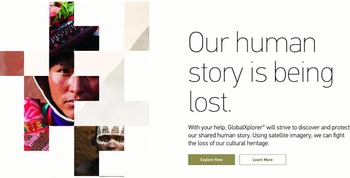
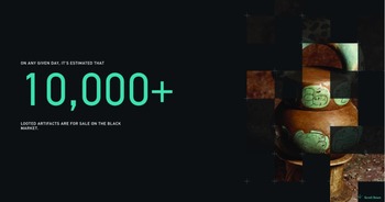
After signing up for GlobalXplorer°, I was presented with large words in black on a stark white background, “Our human story is being lost,” (Figure 1) followed by snippets of information about the presence of looted antiquities on the black market,Footnote 1 (Figure 2) the potential for satellite imagery to help, and an invitation: “Join the expedition and explore Peru.” I clicked “Explore Now.” I was brought directly to the “Looting Tutorial,” which I was asked to complete before I began exploring. It was headed with a sleek video featuring Sarah Parcak, and I was guided through 12 looting identification tips and then invited to search squares of terrain in satellite images for destruction. The tutorial was engaging and effective. It introduced the user not only to what looting looks like from above but also to the entire concept of archaeological pillage in a visual and visceral way. For example, I was asked to watch out for earthmoving equipment at the sites in the satellite images, which, though perhaps unlikely to catch in the act, emphasizes that heritage is literally being leveled. The tutorial left me with about the same level of confidence in my ability to identify features of interest as other citizen science platforms; that is, not much confidence but a desire to learn by doing.
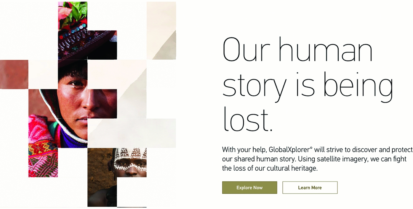
FIGURE 1. GlobalXplorer° landing page inviting the user, “Explore Now.” (Image reproduced with permission of Sarah Parcak.)

FIGURE 2. Archaeological looting on the GlobalXplorer° landing page illustrated by a Maya pot from the site of Río Azul; a similar vessel from a related tomb was infamously looted and trafficked. (Image reproduced with permission of Sarah Parcak.)
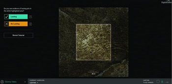
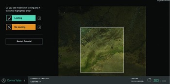
My first square was a rough and rocky area with sandy soils, scrubby plants, and a dry stream cutting through the southeast corner (Figure 3). I did not see any evidence of looting, at least not as described in the tutorial, but I took a second and third look before clicking the “No Looting” button. Although I can reasonably claim expertise in antiquities trafficking, the ancient Andes, and the combination of the two, I did not feel confident that I would recognize looting when I saw it in the image. In the second picture, I again saw nothing (me: “Is that a linear feature? Would I know a linear feature if I saw it?”). The third showed a desert landscape and had a suspicious little nook that I would certainly check out on the ground. Assuming that this was somewhere on Peru's south coast, I could imagine tucking a mummy into that nook and then looting it back out again, but I realized I was overthinking the process. The average GlobalXplorer° user is not using the platform like I am; they will probably not have, say, the early 1930s looting of the Paracas Necropolis in mind (see Tello Reference Tello1959). I resolved to relax a bit. During the course of the next 20 minutes, I saw some beautiful scenery, overhead views of rural Andean homesteads with livestock corrals, several archaeological sites (Figure 4), and a lot of rocks. Much of the time the image resolution was too poor for me to confidently determine what I was looking at. Other images contained rendering errors or were covered in cloud; all told, I found myself often longing for an “image obscured” button as I didn't like to mark terrain to be looting free if I could not see it.

FIGURE 3. My first square on GlobalXplorer°—not much to see here. (Image reproduced with permission of Sarah Parcak.)

FIGURE 4. Another square on GlobalXplorer° clearly showing that much archaeology is visible here, but I could not see any looting. (Image reproduced with permission of Sarah Parcak.)
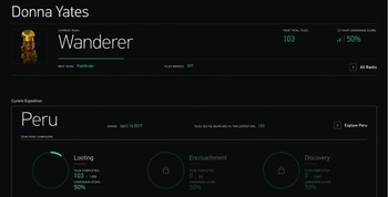
Out of 100 visited tiles, I marked only one as showing signs of looting. I was a bit dismayed when I visited my profile to see that my “Consensus Score” (based on how well my responses to the images I was presented agree with those of other users who have seen the same ones) was only 50% (Figure 5). Either I am wrong, or half of everyone else is. The profile section itself provides several interesting incentives for continuing to evaluate images: I can rank up from “Wanderer” all the way to “Space Archaeologist,” and I can earn access to Reddit “Ask Me Anything” events and Google Hangout sessions with Dr Parcak (“Gosh,” I thought, “she'd be surprised to see me there!”). Most interestingly, it seems as if I can earn access to further tasks entitled “Encroachment” and “Discovery,” which I assume to be marking what might be illicit incursion into archaeological areas for agriculture and development and finding archaeological sites, respectively. I saw both in the images I was given, and both are much easier to see from space than holes. Thus, the experience was certainly gamified, and I felt the urge to keep looking for tiles to unlock further tasks and to gain a better rank. Had I a few more hours in the day, I would have kept going.

FIGURE 5. My GlobalXplorer° dashboard—still just a “Wanderer,” but quite a few rewards have been offered for continuing to explore. (Image reproduced with permission of Sarah Parcak.)
THE ETHICAL QUESTION: RELIABILITY AND RESPONSIBILITY
Since its launch, perhaps the most frequent criticisms of GlobalXplorer° are related to (1) reliability—that the platform will not produce actionable data—and (2) responsibility—that it might lead looters to vulnerable sites. While these are certainly two issues that must be raised, I am not particularly concerned by either of them.
Regarding the second criticism, I believe it is unlikely that a user of the platform will be able to identify and locate an archaeological site from the images provided by GlobalXplorer°. I have worked in the Andes for years specifically on looting, and I recognized nothing. Furthermore, residents of the regions covered by GlobalXplorer° know exactly where archaeological sites are already, especially those who are motivated to illicitly excavate, and the location of sites is regularly revealed in published archaeological reports.
The idea that GlobalXplorer° may not provide the kind of data that Peru's Ministry of Culture can act upon is more complicated, and it is fair to say that questions remain about how the data generated by this platform will be used and by whom. A thousand users marking the vestiges of looting that happened in the 1930s will not give police anything to act upon today, and another thousand users flagging encroachment that was happening on a site five years ago when the image was taken will not result in an intervention.
Yet I do not believe that GlobalXplorer° needs to produce any directly actionable data to be a success. While researching in another country in Latin America in 2014, I was told by its relevant ministry of culture that the last time someone had conducted a survey of looting at sites across the country was in 1980, and that the ministry was still using those numbers. They did not have enough time, money, or staff to conduct an updated survey, however much they would like one. Assuming that some well-considered algorithms and some human eyes are applied to the data generated by GlobalXplorer°,Footnote 2 this platform could produce just such a data set for Peru to refer to. GlobalXplorer°’s output, then, can become a starting point—a minimum “this is where we are”—which would then allow the Ministry of Culture to tailor and target on-the-ground survey and to provide a baseline for future monitoring of change. With this baseline, new sets of satellite imagery can be presented to the GlobalXplorer° user base when they become available, and if users consistently flag an area that was not “hot” before, Peru will know to send a team out. It remains to be seen if repeat monitoring will happen, but from this point on, the data collected by GlobalXplorer° allows for the possibility.
WILL THIS HELP STOP LOOTING?
Does GlobalXplorer° get my vote as an effective means to help stop looting? Indirectly, I think so. By interacting with thousands of satellite images, each of GlobalXplorer°’s 66,000 volunteers experience looting through a unique lens: they are specifically trained through endless repetition to identify physical pillage and, thus, to internalize looting as destructive and harmful. It is difficult to see the harm that results from a display of artifacts in a private museum and, by extension, difficult to inspire the public outrage needed to force changes in policy and cultural practice. Holes in the ground serve as a tangible representation of loss that users of GlobalXplorer° are invited to feel, much like upsetting images of dead elephants invite viewers to feel loss related to the illicit trade in ivory. Half an hour of looking for looting in satellite images might inspire users to be more receptive to media reports of antiquities trafficking cases, challenge shady antiquities actions that they encounter, rebuke acquaintances for buying looted objects, and demand more transparency from the market. GlobalXplorer°, then, can be seen as a component of a larger push for slowly but radically altering how the public sees antiquities and how the public socially controls bad actions related to their collection and commodification. But we need the rest of that larger push, and at the moment, we have relatively few popular and innovative anti-looting initiatives to consider alongside GlobalXplorer°.
All right, everyone, what's our next move?


