

Introduction
Glacier outburst floods, jökulhlaups, are sudden discharges from water bodies dammed within or at the margins of glaciers. At Mount Rainier, the largest dormant volcano in the central Cascade Range of Washington State, U.S.A., one or more glacier outburst floods may occur in any given year, although in some years none occur. Glacial streams on Mount Rainier erode through loose volcanic debris and sudden increases in discharge such as those that occur in outburst floods commonly mobilize this eroded material as debris flows. In the geological record for Mount Rainier, and similarly for other Cascade volcanoes such as Mount Shasta, California, U.S.A., stratigraphic evidence of debris flows (Reference Osterkamp, Hupp and BlodgettOsterkamp and others, 1985) indicates that these flows are seldom associated with eruptive activity (Reference CrandellCrandell, 1971). The outburst floods at Mount Rainier apparently originate from below the glacier surface and no ice-dammed lakes have been observed on the mountain.
This paper presents the results of an analysis of the historical flood records for the Mount Rainier National Park, and theorizes about the source, storage, and release of outburst water.
The Setting
Mount Rainier rises to 4400 m a.s.l. and is a stratovolcano composed of overlapping layers of lava and tephra deposits capped by glaciers (Fig. 1). It last erupted in the mid-nineteenth century (Reference CrandellCrandell, 1971), and some low-level geothermal activity persists. Twenty-five glaciers exist on Mount Rainier, with a total area of 92 km2 of snow and ice cover (Reference Driedger and KennardDriedger and Kennard, 1986). The morphological features of five of Mount Rainier’s flood-producing glaciers, Nisqually, Kautz, South Tahoma, Carbon, and Winthrop, are shown in Table I. Five major rivers have their origins in glaciers on Mount Rainier, Kautz Creek, Tahoma Creek, and the Nisqually River drain the major outburst-producing glaciers, and each has a summer discharge of approximately 1 × 3m3s−1. The three glaciers with the highest historically noted recurrence of floods, Nisqually, Kautz, and South Tacoma Glaciers, drain into the Nisqually River. Nisqually and Kautz Glaciers are situated on the southern flank of Mount Rainier, and both flow from near to the summit crater across a series of basins and cliffs. South Tahoma Glacier is located on the south-western flank of Mount Rainier and discharges water into Tahoma Creek. The glacier is bordered by ridges to the north and south, and also by a 1000 m high headwall. The most obvious feature of the glacier is a 1 km long stretch of stagnating ice that was partially disconnected from the glacier body by an earlier flood and now conceals the margin of the currently active terminus.
Glaciers and permanent snowfields cover about 92 km2 of Mount Rainier. The three glaciers producing most floods, South Tahoma, Kautz, and Nisqually, are located on the southern flank of the mountain. Some floods have emanated from Winthrop Glacier, and outburst flood activity is also suspected on South and North Mowich Glaciers, and Carbon Glacier.

Characteristics of outburst-flood-producing glaciers, mount rainier, washington, U.S.A.

Appraisal of Records of Glacier Outburst Floods
Compilation of data from outburst events helps in identifying which glaciers are likely to be susceptible to outburst floods, and in determining their regional hazard potential (Reference Post and MayoPost and Mayo, 1971; Reference YoungYoung, 1980). The work of Reference HaeberliHaeberli (1983) correlates the morphological characteristics of glaciers, such as area and slope, with frequency and type of outburst. He has found that, in Switzerland, approximately two-thirds of all floods are caused by lake outbursts and the remaining one-third caused by outbursts from unobservable water pockets. The water-pocket floods have tended to originate from those glaciers with steeper-than-average slopes, which are usually greater than 15°. Frequency-distribution data indicate that both water-pocket and lake-outburst floods most usually occur in July and August.
The available information about past floods at Mount Rainier has been reported by Reference RichardsonRichardson (1968), by park personnel, and by others. Some of this information is based on intermittent observations of events by untrained observers. Many small floods have probably gone unrecorded, but Table II is thought to represent a reasonably complete record of the major events of this century. Reference RichardsonRichardson (1968) determined that floods most often occurred during the period of the year from August to October, with a frequency of about one every 3 to 10 years. Reference HodgeHodge (1972) noted some additional events to those which Richardson had reported, and suggested that Nisqually Glacier has generated floods once every 2 years. Recently, even frequency has increased to nine observed events between 1985 and 1987, but many other outburst floods have probably gone unnoticed because of their small volumes or remote locations. During the 87 years since the establishment of Mount Rainier National Park, floods and resulting debris flows have destroyed four highway bridges, several sections of highway, camping grounds and picnic areas, and numerous trail bridges (Reference RichardsonRichardson, 1968). The transformation of an outburst flood into a debris flow increases its destructive potential. The large number of visitors, the increased number of flood events, and the recent destruction of visitors facilities by floods, have all drawn attention to the hazard.
Records for all glaciers on the mountain show that many of the floods occurred in a cluster in time but that, when averaged over the decades, the years 1967 and 1987 had a frequency exceeding one flood per year. However, from 1985 to 1987, the frequency of events averaged three floods per year. In all, there have been nine floods with peak discharges about 1 × 10² m3s−1, 14 with peak values 1 × 10³m3s−1 and one with a value of 1 × 10⁴m3s−1. 60% of the outbursts reported produced debris flows, and 74% either damaged or destroyed Park facilities. 40% of the outburst floods occurred during or immediately after rainfall, and these were some of the largest reported. Several outburst floods were reported to have occurred in surges with periodicities ranging from several minutes to several hours. No precursory stream-flow events have been recorded. It was noted that many floods peaked during the afternoon or evening. The lack of evidence for localized melting indicates that intermittent local area geothermal activity is not responsible for recent flood formation. All floods reported, except for that occurring during 1987 on Winthrop Glacier, appeared to have originated beneath the glacier surface.
A field program was begun in 1987 in order to monitor both glacial outburst floods and possible precursory Sydrologic events occurring within the Park. Measurements of stream-gauge height, electrical conductivity, turbidity, and of meteorological variables were made at two sites each lying both on Kautz Creek and the Nisqually River. Gauge height and conductivity data were also collected from the non-glacierized Paradise River so as to provide a reference set for background conditions. In the summer of 1987 there were no outburst floods from the monitored basins, although four were released from the unmonitored South Tahoma Glacier. Several people witnessed flood events at South Tahoma Creek, and reported similar accounts of floods on 29 June, 28 August, 31 August, and 26 September 1987. The material of the flow was described as being brownish black in colour, with a viscosity similar to that of wet concrete, and the flow carried boulders of up to several meters in diameter. Furthermore, the flood wave was accompanied by strong winds and boulders of up to about 400 mm in diameter that were thrown above the railings of the suspension bridge which stands about 20 m above the stream bed. Down-valley, each of the four floods formed boulder levees along their margins of flow, and rerouted the original stream beds. They inundated a picnic area and a parking lot, deposited material ranging in depth from a few tenths of a meter to several meters of sediment, and buried signs and picnic tables.
All four floods at Tahoma Creek in 1987 occurred
Glacier-outburst flood chronology
during late afternoon or evening. Geomorphological evidence allowed an estimate of peak discharge for each of the four floods to be made; all were of the same order of magnitude, namely about 1 × 10³ m3 s−1. The flood of 26 September mobilized debris up-stream, scouring the upper canyon to a depth of 2 m and depositing sediment farther down-stream to a depth of 1 m or more. Mean velocity of the surface flow was calculated as being 2–3 m s−1. Mud lines on the lee side of trees were used to measure draw-down in a picnic area 7 km down-stream of the glacier.
Theory of Source, Storage, and Release of Water
Because neither geothermal activity nor glacier-dammed lakes have been observed it is conjectured that water is stored within the glacier. Several possibilities are now examined. Water-filled crevasses are common in glaciers, and are often found in marginal shear zones. In order to account for flood volumes of 1 × 10⁵ m3, the value estimated from events in the summer of 1987 at South Tahoma Glacier, the numbers and volumes of crevasse reservoirs must be estimated. If a crevasse depth of 10 m, a surface width of 5 m, and a triangular cross-section are assumed, then 40 crevasses, each 100 m long, would be required to provide the estimated flood volume, the volume per unit length of a typical crevasse being 25 m3. No water-filled crevasses have been observed, making it improbable that the flood water originated at the glacier surface; the same problem of space-accounting applies to connected englacial voids.
The manner in which water is most probably ponded is in subglacial cavities. To account for the large volumes of flood water involved, subglacial cavities may be either small and numerous, or few and very large. Such cavities would be able to provide a sudden flux if water is held under high pressure and thereby relatively isolated from the low-pressure, subglacial hydraulic system. It is thought more likely that a few large cavities would remain isolated than that many small ones would do so.
Given the rough terrain of Mount Rainier, and observations on the bedrock of unglaciated parts of the mountains, cavities could form in the lee of bedrock steps. Detailed descriptions of the mechanics of cavity formation under a variety of conditions have been given by Reference LliboutryLliboutry (1968), Reference IkenIken (1981), and Reference KambKamb (1987). If one quadrant of an elliptical profile in a cavity is assumed (Reference LliboutryLliboutry, 1978), then volume per unit length (V) is given by
where h is the rock-step height and w is the cavity width. Breaks of slope occur in the subglacial terrain as the result of numerous overlapping lava flows; on Mount Rainier there are several steps each of roughly 30 m in height. In order to calculate potential water volume we assume a maximum cavity length of 10 m, for which the volume per unit width is 235 m3 m−1. If this cavity extends along one-half of the distance across a glacier 1 km wide, as would be the case in South Tahoma Glacier where we believe the flood originated, the total cavity volume would be 1.5 × 10⁵ m3. Although this view is a gross simplification, it does provide the basis for a theory in which large cavities are feasible. A single cavity could possibly be solely responsible for the observed floods, although the presence of several smaller hydraulically linked cavities is more likely.
In this situation of relatively isolated cavities, the approach of Reference WalderWalder (1986) seems most applicable. The length, L, of a cavity in the ice-flow direction is the product of the time required for the ice to close an opening created by a step of height R, and the sliding speed of the glacier, so that

where U c is the creep-closure rate, and U s is the sliding speed (Walder’s equation (6)). Substituting bore-hole closure calculation values (Reference NyeNye, 1953) for creep-closure rate, ignoring any enlargement caused by heat generated from the viscous dissipation of energy from flowing water, and assuming an elliptical profile of the cavity, Equation (2) becomes
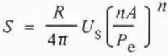
where S is the cross-sectional area, n and A are the exponent and coefficient of the ice-flow law, and P e is effective pressure in the cavity (Walder’s Equation (9), without the melting term). The size of the cavity is linearly related to step and to glacier sliding speed. Reference HaeberliHaeberli (1983) suggested that water-pocket floods are most frequently associated with steep glaciers, and this suggestion can be explained by proposing that the implied greater sliding speed creates larger cavities than would result on more gently sloping glaciers. The most important term in Equation (3) is the effective pressure, which has an inverse power relationship with cavity size. Unfortunately this is the term about which least direct information is available. Larger cavities will decrease the basal shear stress of a glacier and this will result in increased glacier speed (Reference IkenIken, 1981), a fact which explains the conjecture (Reference HodgeHodge, 1972) that surface speed would increase prior to flood events.
The stated relationships now permit a qualitative hypothesis of flood generation from subglacial cavities to be offered. Glacier ice separates from its bed when it encounters a step in the bedrock and creates a cavity. If water flows into this cavity through a connection to a surface crevasse, or from a debris layer, the cavity will enlarge to new dimensions determined by a combination of step size, sliding speed, ice-overburden pressure and water pressure in the cavity, as indicated in Equation (3). If water pressure is high, as is suggested by studies of subglacial debris layers (Reference ClarkeClarke, 1987), the cavity may become extremely large. The cavity will continue to enlarge itself until a connection has been established with a low-pressure hydraulic system, such as a conduit (Reference RothlisbergerRöthlisberger, 1972). Once the connection is made, water is forced from the cavity by the pressure difference between the cavity and conduit, and the flood proceeds as it would do from an ice-dammed lake. Subsequent increased water flux enlarges the conduit using the heat produced by viscous dissipation of energy in the flowing water. Large conduits allow greater water flux, resulting in more heat dissipation, until the cavity reservoir is nearly emptied. When water flux drops rapidly, the pressure of the overlying ice squeezes the cavity connection closed and ends the flood.
There are several implications arising from such a theory of subglacial cavity flood genesis. Hydrographs of stream flow will probably not show precursors of an impending flood, since the flood occurrence depends upon the sudden establishment of a subglacial hydraulic connection. A calculated glacier-water balance, similar to that of Reference Tangborn, Krimmel and MeierTangborn and others (1975), would probably be useful as a means of indicating the magnitude of any sizeable water body already stored in a subglacial cavity. This model could also help to quantify the processes producing the observed higher frequency of floods in mid-to-late summer and leading to the storage of water during spring already estimated by Reference Tangborn, Krimmel and MeierTangborn and others (1975).
The theory of flood genesis from subglacial cavities is also able to explain why a series of outburst events sometimes occurs on Mount Rainier. Once a flood has ended the cavities collapse from the pressure of the ice-overburden pressure and the seal at the cavity exit reforms. Water may continue to drain into the cavity if a connection is maintained either with the surface or with a debris layer on the bedrock steps. When pressure is sufficiently increased the cavity will again become enlarged, setting the stage for another event. As can be seen from Table II, floods do not necessarily occur in a cyclic manner. Their clustered or singular occurrence is dependent on melt-water flux, subglacial conditions, and the presence of cavity connections. Because of multiple possibilities, an accurate numerical model of flood occurrence would be difficult to construct.
Conclusion
Outburst floods on Mount Rainier are dangerous because they occur without warning and trigger debris flows. South Tahoma, Kautz, and Nisqually Glaciers generate the majority of the observed floods on the mountain, although it is recognized that small floods can occur in remote regions throughout the Park and that in any location they may go unnoticed. Glaciers on the south-western slopes of the mountain exhibit a greater flood frequency than those on the north-eastern side, probably because the nature of the stepped bedrock bench at 2100 m a.s.l. on the south-western side makes it more susceptible to cavity development, and also because the greater exposure to storms and more intense solar radiation on the south-western side of the mountain allows a greater water flux through Kautz, Nisqually, and South Tahoma Glaciers. The source of flood water is apparently within, or at the beds of, the glaciers and its release may be subject to the occurrence of appropriate changes in cavity size. This theory reasonably explains why no precursory hydrological events have been seen to precede an outburst occurrence and also why floods sometimes develop in series, perhaps with recurring cavity enlargements. Future modelling of glacier hydrology, and particularly of the subglacial drainage system, is a first step towards estimating flood timing and magnitude.


