
Book contents
- Frontmatter
- Contents
- List of Illustrations
- List of Tables
- Acknowledgements
- List of Abbreviations
- Note on Transliteration
- 1 Introduction: Experiencing the Extraordinary and the Ordinary
- 2 Responses and Responsibilities in Emergency Relief
- 3 From Local to National Politics of Relief
- 4 Colonial Relations in Aid
- 5 Categories of Victims
- 6 Congested and Contested Spaces
- 7 Conclusion
- Glossary
- Bibliography
- Index
1 - Introduction: Experiencing the Extraordinary and the Ordinary
Published online by Cambridge University Press: 13 January 2023

- Frontmatter
- Contents
- List of Illustrations
- List of Tables
- Acknowledgements
- List of Abbreviations
- Note on Transliteration
- 1 Introduction: Experiencing the Extraordinary and the Ordinary
- 2 Responses and Responsibilities in Emergency Relief
- 3 From Local to National Politics of Relief
- 4 Colonial Relations in Aid
- 5 Categories of Victims
- 6 Congested and Contested Spaces
- 7 Conclusion
- Glossary
- Bibliography
- Index
Summary
Continuities and Breaks
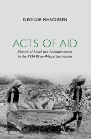
On 15 January 1934, at around 2.13 p.m. an earthquake struck north India and Nepal. In the chronicles of states, popular writers and scientists, the earthquake would be known as ‘the Indian earthquake’, ‘the great Indian earthquake’, ‘the Bihar–Nepal earthquake’, ‘the Bihar earthquake’ and in Nepal as ‘the Great Earthquake’. As some of these titles reveal, Bihar, which the present study focuses on, was the worst-affected region in India: the districts Muzaffarpur, Darbhanga and Champaran in north Bihar, and Monghyr, south of the Ganges, suffered the most extensive human losses and damages. In India somewhere between 7,253 and 20,000 people succumbed and approximately 8,500 died in Nepal in the upheaval measuring M w 8.1 to 8.4 according to re-evaluated historical data. The epicentre located about 10 kilometres south of Mt Everest caused severe damage to infrastructure, agricultural land and a large number of houses in an area extending from the foothills of the Himalayas in Nepal to the southern bank of the Ganges (Map 1.1).
The 1934 earthquake was in many ways a revolutionary event in terms of magnitude and effect: it was a large-scale disaster with an unexpected and sudden onset. Almost exactly one hundred years had elapsed since the last major earthquake occurred in the region in 1833, an event of far less impact in terms of death and destruction, with no deaths reported in India despite damages to houses. After the 1934 earthquake, the 1988 Udaypur (Udaipur) earthquake served as a mild precursor to the recent 25 April 2015 Gorkha earthquake that not only caused extreme destruction and about 8,700 deaths in Nepal, but also severely jolted northern India from Delhi to Kolkata. In combination with findings of historical seismology, these contemporary reminders of Bihar being at risk in the event of regional Himalayan earthquakes have spurred research into engineering and modes of coping. Contemporary earthquake risk reduction in the Kathmandu valley aims at improving building structures and creating awareness. Vital in recommending building techniques and planning dam projects and power plants is research into historical seismology, which serves to estimate location and magnitude of historical earthquakes.
- Type
- Chapter
- Information
- Acts of AidPolitics of Relief and Reconstruction in the 1934 Bihar–Nepal Earthquake, pp. 1 - 48Publisher: Cambridge University PressPrint publication year: 2023
- Creative Commons


 This content is Open Access and distributed under the terms of the Creative Commons Attribution licence CC-BY-NC 4.0 https://creativecommons.org/cclicenses/
 You have
Access
You have
Access
 Open access