Skip to main content Accessibility help
×
Hostname: page-component-cd9895bd7-q99xh Total loading time: 0 Render date: 2024-12-25T10:58:07.406Z Has data issue: false hasContentIssue false

CHAPTER THREE - Methodology II: Remote sensing of change in grasslands

Published online by Cambridge University Press:  22 March 2019
David J. Gibson
Affiliation:
Southern Illinois University, Carbondale
Jonathan A. Newman
Affiliation:
University of Guelph, Ontario
Get access

Summary

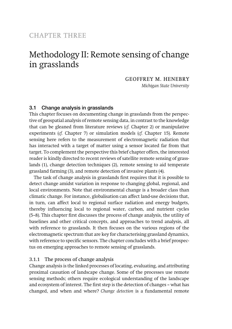
Image of the first page of this content. For PDF version, please use the ‘Save PDF’ preceeding this image.'
Type
Chapter
Information
Publisher: Cambridge University Press
Print publication year: 2019

Access options

Get access to the full version of this content by using one of the access options below. (Log in options will check for institutional or personal access. Content may require purchase if you do not have access.)

References

3.5 References

Ali, I, Cawkwell, F, Dwyer, E, Barrett, B, Green, S. Satellite remote sensing of grasslands: from observation to management. Journal of Plant Ecology. 2016;9(6):649–71.Google Scholar
Lu, D, Li, G, Moran, E. Current situation and needs of change detection techniques. International Journal of Image and Data Fusion. 2014;5(1):1338.CrossRefGoogle Scholar
Wachendorf, M, Fricke, T, Möckel, T. Remote sensing as a tool to assess botanical composition, structure, quantity and quality of temperate grasslands. Grass and Forage Science. 2018;73(1):114.Google Scholar
Bradley, BA. Remote detection of invasive plants: a review of spectral, textural and phenological approaches. Biological Invasions. 2014;16(7):1411–25.CrossRefGoogle Scholar
Baird, IG, Fox, J. How land concessions affect places elsewhere: telecoupling, political ecology, and large-scale plantations in Southern Laos and Northeastern Cambodia. Land. 2015;4(2):436–53.Google Scholar
Boillat, S, Scarpa, FM, Robson, JP, Gasparri, I, Aide, TM, Aguiar, APD, et al. Land system science in Latin America: challenges and perspectives. Current Opinion in Environmental Sustainability. 2017;26:3746.Google Scholar
Carter, NH, Viña, A, Hull, V, McConnell, WJ, Axinn, W, Ghimire, D, et al. Coupled human and natural systems approach to wildlife research and conservation. Ecology and Society. 2014;19(3):43.Google Scholar
Liu, J, Hull, V, Batistella, M, DeFries, R, Dietz, T, Fu, F, et al. Framing sustainability in a telecoupled world. Ecology and Society. 2013;18(2):26.Google Scholar
Wright, CK, Wimberly, MC. Recent land use change in the Western Corn Belt threatens grasslands and wetlands. Proceedings of the National Academy of Sciences. 2013;110(10):4134–9.CrossRefGoogle ScholarPubMed
Shoko, C, Mutanga, O, Dube, T. Progress in the remote sensing of C3 and C4 grass species aboveground biomass over time and space. ISPRS Journal of Photogrammetry and Remote Sensing. 2016;120:1324.CrossRefGoogle Scholar
Arterburn, JR, Twidwell, D, Schacht, WH, Wonkka, CL, Wedin, DA. Resilience of Sandhills grassland to wildfire during drought. Rangeland Ecology & Management. 2018;71(1):53–7.CrossRefGoogle Scholar
de Beurs, K, Henebry, G. A statistical framework for the analysis of long image time series. International Journal of Remote Sensing. 2005;26(8):1551–73.Google Scholar
de Beurs, KM, Henebry, GM. Land surface phenology, climatic variation, and institutional change: analyzing agricultural land cover change in Kazakhstan. Remote Sensing of Environment. 2004;89(4):497509.Google Scholar
Hufkens, K, Keenan, TF, Flanagan, LB, Scott, RL, Bernacchi, CJ, Joo, E, et al. Productivity of North American grasslands is increased under future climate scenarios despite rising aridity. Nature Climate Change. 2016;6(7):710.CrossRefGoogle Scholar
World Meteorological Organization. Guide to climatological practices. WMO-No. 100. Geneva: World Meteorological Organization; 2011.Google Scholar
Briggs, JM, Knapp, AK. Interannual variability in primary production in tallgrass prairie: climate, soil moisture, topographic position, and fire as determinants of aboveground biomass. American Journal of Botany. 1995;82(8):1024–30.Google Scholar
Sala, OE, Gherardi, LA, Reichmann, L, Jobbagy, E, Peters, D. Legacies of precipitation fluctuations on primary production: theory and data synthesis. Philosophical Transactions of the Royal Society B: Biological Sciences. 2012;367(1606):3135–44.Google Scholar
Sala, OE, Austin, AT. Methods of estimating aboveground net primary productivity. In: Sala, OE, Jackson, RB, Mooney, HA, Howarth, RW, editors. Methods in ecosystem science. New York, NY: Springer; 2000. pp. 3143.Google Scholar
Lauenroth, WK. Methods of estimating belowground net primary production. In: Sala, OE, Jackson, RB, Mooney, HA, Howarth, RW, editors. Methods in ecosystem science. New York, NY: Springer; 2000. pp. 5871.Google Scholar
Oesterheld, M, McNaughton, SJ. Herbivory in terrestrial ecosystems. In: Sala, OE, Jackson, RB, Mooney, HA, Howarth, RW, editors. Methods in ecosystem science. New York, NY: Springer; 2000. pp. 151–7.Google Scholar
Sun, F, Roderick, ML, Farquhar, GD. Rainfall statistics, stationarity, and climate change. Proceedings of the National Academy of Sciences. 2018;115(10):2305–10.Google Scholar
Weatherhead, EC, Reinsel, GC, Tiao, GC, Meng, XL, Choi, D, Cheang, WK, et al. Factors affecting the detection of trends: statistical considerations and applications to environmental data. Journal of Geophysical Research: Atmospheres. 1998;103(D14):17,149–61.Google Scholar
de Beurs, KM, Henebry, GM. Trend analysis of the Pathfinder AVHRR Land (PAL) NDVI data for the deserts of Central Asia. IEEE Geoscience and Remote Sensing Letters. 2004;1(4):282–6.Google Scholar
de Beurs, KM, Henebry, GM, Owsley, BC, Sokolik, I. Using multiple remote sensing perspectives to identify and attribute land surface dynamics in Central Asia 2001–2013. Remote Sensing of Environment. 2015;170:4861.CrossRefGoogle Scholar
Hess, A, Iyer, H, Malm, W. Linear trend analysis: a comparison of methods. Atmospheric Environment. 2001;35(30):5211–22.Google Scholar
Hirsch, RM, Slack, JR. A nonparametric trend test for seasonal data with serial dependence. Water Resources Research. 1984;20(6):727–32.Google Scholar
Strahler, AH, Woodcock, CE, Smith, JA. On the nature of models in remote sensing. Remote Sensing of Environment. 1986;20(2):121–39.CrossRefGoogle Scholar
Goodin, D, Henebry, G. Seasonality of finely-resolved spatial structure of NDVI and its component reflectances in tallgrass prairie. International Journal of Remote Sensing. 1998;19(16):3213–20.CrossRefGoogle Scholar
Goodin, DG, Gao, J, Henebry, GM. The effect of solar illumination angle and sensor view angle on observed patterns of spatial structure in tallgrass prairie. IEEE Transactions on Geoscience and Remote Sensing. 2004;42(1):154–65.Google Scholar
Henebry, GM. Detecting change in grasslands using measures of spatial dependence with Landsat TM data. Remote Sensing of Environment. 1993;46(2):223–34.Google Scholar
Henebry, GM. Grasslands of the North American great plains. In: Schwartz, MD, editor. Phenology: an integrative environmental science. New York, NY: Springer; 2003. pp. 157–74.Google Scholar
Henebry, GM. Phenologies of North American grasslands and grasses. In: Schwartz, MD, editor. Phenology: an integrative environmental science. New York, NY: Springer; 2013. pp. 197210.CrossRefGoogle Scholar
Henebry, GM, de Beurs, KM. Remote sensing of land surface phenology: a prospectus. In: Schwartz, MD, editor. Phenology: an integrative environmental science. New York, NY: Springer; 2013. pp. 385411.Google Scholar
Still, CJ, Pau, S, Edwards, EJ. Land surface skin temperature captures thermal environments of C3 and C4 grasses. Global Ecology and Biogeography. 2014;23(3):286–96.Google Scholar
Meroni, M, Rossini, M, Guanter, L, Alonso, L, Rascher, U, Colombo, R, et al. Remote sensing of solar-induced chlorophyll fluorescence: review of methods and applications. Remote Sensing of Environment. 2009;113(10):2037–51.Google Scholar
Huete, A, Didan, K, Miura, T, Rodriguez, EP, Gao, X, Ferreira, LG. Overview of the radiometric and biophysical performance of the MODIS vegetation indices. Remote Sensing of Environment. 2002;83(1–2):195213.Google Scholar
Tucker, CJ. Red and photographic infrared linear combinations for monitoring vegetation. Remote Sensing of Environment. 1979;8(2):127–50.CrossRefGoogle Scholar
Ciganda, VS, Gitelson, AA, Schepers, J. How deep does a remote sensor sense? Expression of chlorophyll content in a maize canopy. Remote Sensing of Environment. 2012;126:240–7.Google Scholar
Inoue, Y, Guérif, M, Baret, F, Skidmore, A, Gitelson, A, Schlerf, M, et al. Simple and robust methods for remote sensing of canopy chlorophyll content: a comparative analysis of hyperspectral data for different types of vegetation. Plant, Cell & Environment. 2016;39(12):2609–23.Google Scholar
Kira, O, Linker, R, Gitelson, A. Non-destructive estimation of foliar chlorophyll and carotenoid contents: focus on informative spectral bands. International Journal of Applied Earth Observation and Geoinformation. 2015;38:251–60.Google Scholar
Fassnacht, FE, Stenzel, S, Gitelson, AA. Non-destructive estimation of foliar carotenoid content of tree species using merged vegetation indices. Journal of Plant Physiology. 2015;176:210–7.Google Scholar
Gitelson, AA, Chivkunova, OB, Merzlyak, MN. Nondestructive estimation of anthocyanins and chlorophylls in anthocyanic leaves. American Journal of Botany. 2009;96(10):1861–8.Google Scholar
Gitelson, AA, Keydan, GP, Merzlyak, MN. Three‐band model for noninvasive estimation of chlorophyll, carotenoids, and anthocyanin contents in higher plant leaves. Geophysical Research Letters. 2006;33(11).Google Scholar
Gamon, J, Penuelas, J, Field, C. A narrow-waveband spectral index that tracks diurnal changes in photosynthetic efficiency. Remote Sensing of Environment. 1992;41(1):3544.Google Scholar
Gamon, J, Serrano, L, Surfus, J. The photochemical reflectance index: an optical indicator of photosynthetic radiation use efficiency across species, functional types, and nutrient levels. Oecologia. 1997;112(4):492501.Google Scholar
Nguy-Robertson, AL, Peng, Y, Gitelson, AA, Arkebauer, TJ, Pimstein, A, Herrmann, I, et al. Estimating green LAI in four crops: potential of determining optimal spectral bands for a universal algorithm. Agricultural and Forest Meteorology. 2014;192:140–8.Google Scholar
Gao, B-C. NDWI – a normalized difference water index for remote sensing of vegetation liquid water from space. Remote Sensing of Environment. 1996;58(3):257–66.Google Scholar
Hardisky, M, Klemas, V, Smart, M. The influence of soil salinity, growth form, and leaf moisture on the spectral radiance of Spartina alterniflora canopies. Photogrammatic Engineering and Remote Sensing. 1983;48:7783.Google Scholar
Hunt, Jr ER, Rock, BN. Detection of changes in leaf water content using near- and middle-infrared reflectances. Remote Sensing of Environment. 1989;30(1):4354.Google Scholar
Delbart, N, Kergoat, L, Le Toan, T, Lhermitte, J, Picard, G. Determination of phenological dates in boreal regions using normalized difference water index. Remote Sensing of Environment. 2005;97(1):2638.Google Scholar
Wang, L, Qu, JJ. NMDI: a normalized multi‐band drought index for monitoring soil and vegetation moisture with satellite remote sensing. Geophysical Research Letters. 2007;34(20).CrossRefGoogle Scholar
Nagler, P, Daughtry, C, Goward, S. Plant litter and soil reflectance. Remote Sensing of Environment. 2000;71(2):207–15.Google Scholar
Nagler, PL, Inoue, Y, Glenn, E, Russ, A, Daughtry, C. Cellulose absorption index (CAI) to quantify mixed soil–plant litter scenes. Remote Sensing of Environment. 2003;87(2–3):310–25.Google Scholar
Ren, H, Zhou, G, Zhang, F, Zhang, X. Evaluating cellulose absorption index (CAI) for non-photosynthetic biomass estimation in the desert steppe of Inner Mongolia. Chinese Science Bulletin. 2012;57(14):1716–22.Google Scholar
Wan, Z. New refinements and validation of the collection-6 MODIS land-surface temperature/emissivity product. Remote Sensing of Environment. 2014;140:3645.Google Scholar
Allen, RG, Tasumi, M, Trezza, R. Satellite-based energy balance for mapping evapotranspiration with internalized calibration (METRIC) – Model. Journal of Irrigation and Drainage Engineering. 2007;133(4):380–94.Google Scholar
Anderson, MC, Allen, RG, Morse, A, Kustas, WP. Use of Landsat thermal imagery in monitoring evapotranspiration and managing water resources. Remote Sensing of Environment. 2012;122:5065.Google Scholar
Justice, C, Giglio, L, Korontzi, S, Owens, J, Morisette, J, Roy, D, et al. The MODIS fire products. Remote Sensing of Environment. 2002;83(1–2):244–62.CrossRefGoogle Scholar
Tulbure, MG, Wimberly, MC, Roy, DP, Henebry, GM. Spatial and temporal heterogeneity of agricultural fires in the central United States in relation to land cover and land use. Landscape Ecology. 2011;26(2):211–24.CrossRefGoogle Scholar
Henebry, G. Mapping human settlements using the mid-IR: advantages, prospects, and limitations. In: Weng, Q, Quattrochi, D, editors. Urban remote sensing. Boca Raton, FL: CRC Press; 2006. pp. 339–55.Google Scholar
Krehbiel, CP, Kovalskyy, V, Henebry, GM. Exploring the middle infrared region for urban remote sensing: seasonal and view angle effects. Remote Sensing Letters. 2013;4(12):1147–55.CrossRefGoogle Scholar
Tomaszewska, M, Henebry, GM. Urban–rural contrasts in central-eastern European cities using a MODIS 4 micron time series. Remote Sensing. 2016;8(11):924.Google Scholar
Jones, LA, Ferguson, CR, Kimball, JS, Zhang, K, Chan, STK, McDonald, KC, et al. Satellite microwave remote sensing of daily land surface air temperature minima and maxima from AMSR-E. IEEE Journal of Selected Topics in Applied Earth Observations and Remote Sensing. 2010;3(1):111–23.CrossRefGoogle Scholar
Kim, H, Parinussa, R, Konings, AG, Wagner, W, Cosh, MH, Lakshmi, V, et al. Global-scale assessment and combination of SMAP with ASCAT (active) and AMSR2 (passive) soil moisture products. Remote Sensing of Environment. 2018;204:260–75.Google Scholar
Kim, Y, Kimball, JS, McDonald, KC, Glassy, J. Developing a global data record of daily landscape freeze/thaw status using satellite passive microwave remote sensing. IEEE Transactions on Geoscience and Remote Sensing. 2011;49(3):949–60.Google Scholar
Velpuri, NM, Senay, GB, Morisette, JT. Evaluating new SMAP soil moisture for drought monitoring in the rangelands of the US high plains. Rangelands. 2016;38(4):183–90.Google Scholar
Jones, MO, Jones, LA, Kimball, JS, McDonald, KC. Satellite passive microwave remote sensing for monitoring global land surface phenology. Remote Sensing of Environment. 2011;115(4):1102–14.Google Scholar
Liu, YY, de Jeu, RA, McCabe, MF, Evans, JP, van Dijk, AI. Global long‐term passive microwave satellite‐based retrievals of vegetation optical depth. Geophysical Research Letters. 2011;38(18).Google Scholar
Du, J, Kimball, JS, Jones, LA, Kim, Y, Glassy, J, Watts, JD. A global satellite environmental data record derived from AMSR-E and AMSR2 microwave Earth observations. Earth System Science Data. 2017;9(2):791.Google Scholar
Guan, K, Berry, JA, Zhang, Y, Joiner, J, Guanter, L, Badgley, G, et al. Improving the monitoring of crop productivity using spaceborne solar‐induced fluorescence. Global Change Biology. 2016;22(2):716–26.Google Scholar
Guanter, L, Zhang, Y, Jung, M, Joiner, J, Voigt, M, Berry, JA, et al. Global and time-resolved monitoring of crop photosynthesis with chlorophyll fluorescence. Proceedings of the National Academy of Sciences. 2014;111(14):E1327–33.CrossRefGoogle ScholarPubMed
Jeong, S-J, Schimel, D, Frankenberg, C, Drewry, DT, Fisher, JB, Verma, M, et al. Application of satellite solar-induced chlorophyll fluorescence to understanding large-scale variations in vegetation phenology and function over northern high latitude forests. Remote Sensing of Environment. 2017;190:178–87.Google Scholar
Joiner, J, Yoshida, Y, Vasilkov, A, Middleton, E. First observations of global and seasonal terrestrial chlorophyll fluorescence from space. Biogeosciences. 2011;8(3):637–51.Google Scholar
Yoshida, Y, Joiner, J, Tucker, C, Berry, J, Lee, J-E, Walker, G, et al. The 2010 Russian drought impact on satellite measurements of solar-induced chlorophyll fluorescence: insights from modeling and comparisons with parameters derived from satellite reflectances. Remote Sensing of Environment. 2015;166:163–77.Google Scholar
Schuster, C, Schmidt, T, Conrad, C, Kleinschmit, B, Förster, M. Grassland habitat mapping by intra-annual time series analysis – comparison of RapidEye and TerraSAR-X satellite data. International Journal of Applied Earth Observation and Geoinformation. 2015;34:2534.Google Scholar
Tamm, T, Zalite, K, Voormansik, K, Talgre, L. Relating Sentinel-1 interferometric coherence to mowing events on grasslands. Remote Sensing. 2016;8(10):802.Google Scholar
Voormansik, K, Jagdhuber, T, Zalite, K, Noorma, M, Hajnsek, I. Observations of cutting practices in agricultural grasslands using polarimetric SAR. IEEE Journal of Selected Topics in Applied Earth Observations and Remote Sensing. 2016;9(4):1382–96.CrossRefGoogle Scholar
Zalite, K, Antropov, O, Praks, J, Voormansik, K, Noorma, M. Monitoring of agricultural grasslands with time series of X-band repeat-pass interferometric SAR. IEEE Journal of Selected Topics in Applied Earth Observations and Remote Sensing. 2016;9(8):3687–97.CrossRefGoogle Scholar
El Hajj, M, Baghdadi, N, Zribi, M, Belaud, G, Cheviron, B, Courault, D, et al. Soil moisture retrieval over irrigated grassland using X-band SAR data. Remote Sensing of Environment. 2016;176:202–18.CrossRefGoogle Scholar
El Hajj, ME, Baghdadi, N, Belaud, G, Zribi, M, Cheviron, B, Courault, D, et al. Irrigated grassland monitoring using a time series of terraSAR-X and COSMO-skyMed X-Band SAR Data. Remote Sensing. 2014;6(10):10,002–32.Google Scholar
Hodgson, ME, Jensen, J, Raber, G, Tullis, J, Davis, BA, Thompson, G, et al. An evaluation of lidar-derived elevation and terrain slope in leaf-off conditions. Photogrammetric Engineering & Remote Sensing. 2005;71(7):817–23.Google Scholar
Mulder, V, De Bruin, S, Schaepman, M, Mayr, T. The use of remote sensing in soil and terrain mapping – a review. Geoderma. 2011;162(1–2):119.Google Scholar
Sankey, JB, Ravi, S, Wallace, CS, Webb, RH, Huxman, TE. Quantifying soil surface change in degraded drylands: shrub encroachment and effects of fire and vegetation removal in a desert grassland. Journal of Geophysical Research: Biogeosciences. 2012;117(G2).Google Scholar
Brown, OW, Hugenholtz, CH. Estimating aerodynamic roughness (zo) in mixed grassland prairie with airborne LiDAR. Canadian Journal of Remote Sensing. 2012;37(4):422–8.Google Scholar
Kulawardhana, RW, Popescu, SC, Feagin, RA. Airborne lidar remote sensing applications in non-forested short stature environments: a review. Annals of Forest Research. 2017;60(1):173.Google Scholar
Hantson, W, Kooistra, L, Slim, PA. Mapping invasive woody species in coastal dunes in the Netherlands: a remote sensing approach using LIDAR and high‐resolution aerial photographs. Applied Vegetation Science. 2012;15(4):536–47.Google Scholar
Bork, EW, Su, JG. Integrating LIDAR data and multispectral imagery for enhanced classification of rangeland vegetation: a meta analysis. Remote Sensing of Environment. 2007;111(1):1124.Google Scholar
Zlinszky, A, Schroiff, A, Kania, A, Deák, B, Mücke, W, Vári, Á, et al. Categorizing grassland vegetation with full-waveform airborne laser scanning: a feasibility study for detecting Natura 2000 habitat types. Remote Sensing. 2014;6(9):8056–87.Google Scholar
Eitel, JU, Williams, CJ, Vierling, LA, Al-Hamdan, OZ, Pierson, FB. Suitability of terrestrial laser scanning for studying surface roughness effects on concentrated flow erosion processes in rangelands. Catena. 2011;87(3):398407.CrossRefGoogle Scholar
Radtke, PJ, Boland, HT, Scaglia, G. An evaluation of overhead laser scanning to estimate herbage removals in pasture quadrats. Agricultural and Forest Meteorology. 2010;150(12):1523–8.Google Scholar
Feagin, RA, Williams, AM, Popescu, S, Stukey, J, Washington-Allen, RA. The use of terrestrial laser scanning (TLS) in dune ecosystems: the lessons learned. Journal of Coastal Research. 2012;30(1):111–9.Google Scholar
Browning, DM, Maynard, JJ, Karl, JW, Peters, DC. Breaks in MODIS time series portend vegetation change – verification using long‐term data in an arid grassland ecosystem. Ecological Applications. 2017;27:1677–93.Google Scholar
Li, Z, Chen, Y, Li, W, Deng, H, Fang, G. Potential impacts of climate change on vegetation dynamics in Central Asia. Journal of Geophysical Research: Atmospheres. 2015;120(24):12,345–56.Google Scholar
Wu, C, Hou, X, Peng, D, Gonsamo, A, Xu, S. Land surface phenology of China’s temperate ecosystems over 1999–2013: spatial–temporal patterns, interaction effects, covariation with climate and implications for productivity. Agricultural and Forest Meteorology. 2016;216:177–87.Google Scholar
Gao, Q, Schwartz, MW, Zhu, W, Wan, Y, Qin, X, Ma, X, et al. Changes in global grassland productivity during 1982 to 2011 attributable to climatic factors. Remote Sensing. 2016;8(5):384.Google Scholar
Hilker, T, Natsagdorj, E, Waring, RH, Lyapustin, A, Wang, Y. Satellite observed widespread decline in Mongolian grasslands largely due to overgrazing. Global Change Biology. 2014;20(2):418–28.Google Scholar
Klein, I, Gessner, U, Kuenzer, C. Regional land cover mapping and change detection in Central Asia using MODIS time-series. Applied Geography. 2012;35(1–2):219–34.CrossRefGoogle Scholar
Roumiguié, A, Sigel, G, Poilvé, H, Bouchard, B, Vrieling, A, Jacquin, A. Insuring forage through satellites: testing alternative indices against grassland production estimates for France. International Journal of Remote Sensing. 2017;38(7):1912–39.Google Scholar
Alemu, W, Henebry, G. Land surface phenologies and seasonalities using cool earthlight in mid-latitude croplands. Environmental Research Letters. 2013;8(4):045002.Google Scholar
Barraza, V, Restrepo-Coupe, N, Huete, A, Grings, F, Beringer, J, Cleverly, J, et al. Estimation of latent heat flux over savannah vegetation across the North Australian Tropical Transect from multiple sensors and global meteorological data. Agricultural and Forest Meteorology. 2017;232:689703.Google Scholar
Guan, K, Medvigy, D, Wood, EF, Caylor, KK, Li, S, Jeong, S-J. Deriving vegetation phenological time and trajectory information over Africa using SEVIRI daily LAI. IEEE Transactions on Geoscience and Remote Sensing. 2014;52(2):1113–30.CrossRefGoogle Scholar
Kolassa, J, Reichle, R, Liu, Q, Alemohammad, S, Gentine, P, Aida, K, et al. Estimating surface soil moisture from SMAP observations using a Neural Network technique. Remote Sensing of Environment. 2018;204:4359.Google Scholar
Schuster, C, Ali, I, Lohmann, P, Frick, A, Förster, M, Kleinschmit, B. Towards detecting swath events in TerraSAR-X time series to establish NATURA 2000 grassland habitat swath management as monitoring parameter. Remote Sensing. 2011;3(7):1308–22.Google Scholar
Baghdadi, NN, El Hajj, M, Zribi, M, Fayad, I. Coupling SAR C-band and optical data for soil moisture and leaf area index retrieval over irrigated grasslands. IEEE Journal of Selected Topics in Applied Earth Observations and Remote Sensing. 2016;9(3):1229–43.Google Scholar
Dusseux, P, Corpetti, T, Hubert-Moy, L, Corgne, S. Combined use of multi-temporal optical and radar satellite images for grassland monitoring. Remote Sensing. 2014;6(7):6163–82.CrossRefGoogle Scholar
Barrett, B, Nitze, I, Green, S, Cawkwell, F. Assessment of multi-temporal, multi-sensor radar and ancillary spatial data for grasslands monitoring in Ireland using machine learning approaches. Remote Sensing of Environment. 2014;152:109–24.Google Scholar
Hong, G, Zhang, A, Zhou, F, Brisco, B. Integration of optical and synthetic aperture radar (SAR) images to differentiate grassland and alfalfa in Prairie area. International Journal of Applied Earth Observation and Geoinformation. 2014;28:12–9.Google Scholar
Joshi, N, Baumann, M, Ehammer, A, Fensholt, R, Grogan, K, Hostert, P, et al. A review of the application of optical and radar remote sensing data fusion to land use mapping and monitoring. Remote Sensing. 2016;8(1):70.Google Scholar
Wang, J, Xiao, X, Qin, Y, Dong, J, Geissler, G, Zhang, G, et al. Mapping the dynamics of eastern redcedar encroachment into grasslands during 1984–2010 through PALSAR and time series Landsat images. Remote Sensing of Environment. 2017;190:233–46.Google Scholar
Loveland, TR, Irons, JR. Landsat 8: the plans, the reality, and the legacy. Remote Sensing of Environment. 2016;185:16.Google Scholar
Roy, DP, Wulder, M, Loveland, TR, Woodcock, C, Allen, R, Anderson, M, et al. Landsat-8: science and product vision for terrestrial global change research. Remote Sensing of Environment. 2014;145:154–72.Google Scholar
Loveland, TR, Cochrane, MA, Henebry, GM. Landsat still contributing to environmental research. Trends in Ecology & Evolution. 2008;23(4):182–3.CrossRefGoogle ScholarPubMed
Wulder, MA, Masek, JG, Cohen, WB, Loveland, TR, Woodcock, CE. Opening the archive: how free data has enabled the science and monitoring promise of Landsat. Remote Sensing of Environment. 2012;122:210.Google Scholar
Wulder, MA, White, JC, Loveland, TR, Woodcock, CE, Belward, AS, Cohen, WB, et al. The global Landsat archive: status, consolidation, and direction. Remote Sensing of Environment. 2016;185:271–83.Google Scholar
Hansen, MC, Loveland, TR. A review of large area monitoring of land cover change using Landsat data. Remote Sensing of Environment. 2012;122:6674.Google Scholar
Roy, DP, Ju, J, Kline, K, Scaramuzza, PL, Kovalskyy, V, Hansen, M, et al. Web-enabled Landsat Data (WELD): Landsat ETM+ composited mosaics of the conterminous United States. Remote Sensing of Environment. 2010;114(1):3549.CrossRefGoogle Scholar
Hansen, MC, Potapov, PV, Moore, R, Hancher, M, Turubanova, S, Tyukavina, A, et al. High-resolution global maps of 21st-century forest cover change. Science. 2013;342(6160):850–3.Google Scholar
Hansen, M, Egorov, A, Potapov, P, Stehman, S, Tyukavina, A, Turubanova, S, et al. Monitoring conterminous United States (CONUS) land cover change with web-enabled Landsat data (WELD). Remote Sensing of Environment. 2014;140:466–84.Google Scholar
Wulder, MA, Hilker, T, White, JC, Coops, NC, Masek, JG, Pflugmacher, D, et al. Virtual constellations for global terrestrial monitoring. Remote Sensing of Environment. 2015;170:6276.Google Scholar
Roy, DP, Li, J, Zhang, HK, Yan, L, Huang, H, Li, Z. Examination of Sentinel-2A multi-spectral instrument (MSI) reflectance anisotropy and the suitability of a general method to normalize MSI reflectance to nadir BRDF adjusted reflectance. Remote Sensing of Environment. 2017;199:2538.CrossRefGoogle Scholar
Storey, J, Roy, DP, Masek, J, Gascon, F, Dwyer, J, Choate, M. A note on the temporary misregistration of Landsat-8 Operational Land Imager (OLI) and Sentinel-2 Multi Spectral Instrument (MSI) imagery. Remote Sensing of Environment. 2016;186:121–2.Google Scholar
de Beurs, KM, Owsley, BC, Julian, JP. Disturbance analyses of forests and grasslands with MODIS and Landsat in New Zealand. International Journal of Applied Earth Observation and Geoinformation. 2016;45:4254.Google Scholar
Tarantino, C, Adamo, M, Lucas, R, Blonda, P. Detection of changes in semi-natural grasslands by cross correlation analysis with WorldView-2 images and new Landsat 8 data. Remote Sensing of Environment. 2016;175:6572.Google Scholar
Franke, J, Keuck, V, Siegert, F. Assessment of grassland use intensity by remote sensing to support conservation schemes. Journal for Nature Conservation. 2012;20(3):125–34.Google Scholar
Whitehead, K, Hugenholtz, CH. Remote sensing of the environment with small unmanned aircraft systems (UASs), part 1: a review of progress and challenges. Journal of Unmanned Vehicle Systems. 2014;2(3):6985.Google Scholar
Müllerová, J, Brůna, J, Bartaloš, T, Dvořák, P, Vítková, M, Pyšek, P. Timing is important: unmanned aircraft vs. satellite imagery in plant invasion monitoring. Frontiers in Plant Science. 2017;8:887.Google Scholar
Müllerová, J, Pergl, J, Pyšek, P. Remote sensing as a tool for monitoring plant invasions: testing the effects of data resolution and image classification approach on the detection of a model plant species Heracleum mantegazzianum (giant hogweed). International Journal of Applied Earth Observation and Geoinformation. 2013;25:5565.Google Scholar
Capolupo, A, Kooistra, L, Berendonk, C, Boccia, L, Suomalainen, J. Estimating plant traits of grasslands from UAV-acquired hyperspectral images: a comparison of statistical approaches. ISPRS International Journal of Geo-Information. 2015;4(4):2792–820.Google Scholar
Möckel, T, Dalmayne, J, Schmid, BC, Prentice, HC, Hall, K. Airborne hyperspectral data predict fine-scale plant species diversity in grazed dry grasslands. Remote Sensing. 2016;8(2):133.Google Scholar
Müllerová, J. Use of digital aerial photography for sub-alpine vegetation mapping: a case study from the Krkonoše Mts., Czech Republic. Plant Ecology. 2005;175(2):259–72.Google Scholar
Murray, DB, White, JD, Swint, P. Woody vegetation persistence and disturbance in central Texas grasslands inferred from multidecadal historical aerial photographs. Rangeland Ecology & Management. 2013;66(3):297304.Google Scholar
Lele, N, Singh, C, Singh, R, Chauhan, J, Parihar, J. Space-based long-term observation of shrinking grassland habitat: a case-study from central India. Journal of Earth System Science. 2015;124(7):1389–98.Google Scholar
Ruelland, D, Levavasseur, F, Tribotté, A. Patterns and dynamics of land-cover changes since the 1960s over three experimental areas in Mali. International Journal of Applied Earth Observation and Geoinformation. 2010;12:S11–7.Google Scholar
Alberton, B, Almeida, J, Helm, R, Torres, RdS, Menzel, A, Morellato, LPC. Using phenological cameras to track the green up in a cerrado savanna and its on-the-ground validation. Ecological Informatics. 2014;19:6270.Google Scholar
Inoue, T, Nagai, S, Kobayashi, H, Koizumi, H. Utilization of ground-based digital photography for the evaluation of seasonal changes in the aboveground green biomass and foliage phenology in a grassland ecosystem. Ecological Informatics. 2015;25:19.CrossRefGoogle Scholar
Julitta, T, Cremonese, E, Migliavacca, M, Colombo, R, Galvagno, M, Siniscalco, C, et al. Using digital camera images to analyse snowmelt and phenology of a subalpine grassland. Agricultural and Forest Meteorology. 2014;198:116–25.Google Scholar
Zhang, X, Jayavelu, S, Liu, L, Friedl, MA, Henebry, GM, Liu, Y, et al. Evaluation of land surface phenology from VIIRS data using time series of PhenoCam imagery. Agricultural and Forest Meteorology. 2018;256:137–49.Google Scholar
Liu, Y, Hill, MJ, Zhang, X, Wang, Z, Richardson, AD, Hufkens, K, et al. Using data from Landsat, MODIS, VIIRS and PhenoCams to monitor the phenology of California oak/grass savanna and open grassland across spatial scales. Agricultural and Forest Meteorology. 2017;237:311–25.Google Scholar
Migliavacca, M, Galvagno, M, Cremonese, E, Rossini, M, Meroni, M, Sonnentag, O, et al. Using digital repeat photography and eddy covariance data to model grassland phenology and photosynthetic CO2 uptake. Agricultural and Forest Meteorology. 2011;151(10):1325–37.Google Scholar
Hill, MJ. Vegetation index suites as indicators of vegetation state in grassland and savanna: an analysis with simulated SENTINEL 2 data for a North American transect. Remote Sensing of Environment. 2013;137:94111.Google Scholar
Lee, CM, Cable, ML, Hook, SJ, Green, RO, Ustin, SL, Mandl, DJ, et al. An introduction to the NASA Hyperspectral InfraRed Imager (HyspIRI) mission and preparatory activities. Remote Sensing of Environment. 2015;167:619.Google Scholar
Girod, L, Nuth, C, Kääb, A, McNabb, R, Galland, O. MMASTER: Improved ASTER DEMs for elevation change monitoring. Remote Sensing. 2017;9(7):704.Google Scholar
Becek, K, Koppe, W, Kutoğlu, ŞH. Evaluation of vertical accuracy of the WorldDEM™ using the runway method. Remote Sensing. 2016;8(11):934.Google Scholar
Guan, K, Wood, EF, Medvigy, D, Kimball, J, Pan, M, Caylor, KK, et al. Terrestrial hydrological controls on land surface phenology of African savannas and woodlands. Journal of Geophysical Research: Biogeosciences. 2014;119(8):1652–69.Google Scholar
Yan, D, Zhang, X, Yu, Y, Guo, W. A comparison of tropical rainforest phenology retrieved from geostationary (SEVIRI) and polar-orbiting (MODIS) sensors across the Congo basin. IEEE Transactions on Geoscience and Remote Sensing. 2016;54(8):4867–81.Google Scholar
Yan, D, Zhang, X, Yu, Y, Guo, W, Hanan, NP. Characterizing land surface phenology and responses to rainfall in the Sahara desert. Journal of Geophysical Research: Biogeosciences. 2016;121(8):2243–60.Google Scholar
Bessho, K, Date, K, Hayashi, M, Ikeda, A, Imai, T, Inoue, H, et al. An introduction to Himawari-8/9 – Japan’s new-generation geostationary meteorological satellites. Journal of the Meteorological Society of Japan Series II. 2016;94(2):151–83.Google Scholar
Schmit, TJ, Griffith, P, Gunshor, MM, Daniels, JM, Goodman, SJ, Lebair, WJ. A closer look at the ABI on the GOES-R series. Bulletin of the American Meteorological Society. 2017;98(4):681–98.Google Scholar
Li, J, Roy, DP. global, A analysis of Sentinel-2A, Sentinel-2B and Landsat-8 data revisit intervals and implications for terrestrial monitoring. Remote Sensing. 2017;9(9):902.Google Scholar
Houborg, R, McCabe, MF. High-resolution NDVI from Planet’s constellation of earth observing nano-satellites: a new data source for precision agriculture. Remote Sensing. 2016;8(9):768.Google Scholar
Houborg, R, McCabe, MF. A cubesat enabled spatio-temporal enhancement method (CESTEM) utilizing Planet, Landsat and MODIS data. Remote Sensing of Environment. 2018;209:211–26.Google Scholar
Wigneron, J-P, Jackson, T, O’Neill, P, De Lannoy, G, De Rosnay, P, Walker, J, et al. Modelling the passive microwave signature from land surfaces: a review of recent results and application to the L-band SMOS … SMAP soil moisture retrieval algorithms. Remote Sensing of Environment. 2017;192:238–62.Google Scholar
Alemu, WG, Henebry, GM. Comparing passive microwave with visible-to-near-infrared phenometrics in croplands of northern Eurasia. Remote Sensing. 2017;9(6):613.Google Scholar
Alemu, WG, Henebry, GM. Land surface phenology and seasonality using cool earthlight in croplands of eastern Africa and the linkages to crop production. Remote Sensing. 2017;9(9):914.Google Scholar
Coppo, P, Taiti, A, Pettinato, L, Francois, M, Taccola, M, Drusch, M. Fluorescence imaging spectrometer (FLORIS) for ESA FLEX mission. Remote Sensing. 2017;9(7):649.Google Scholar
Moore, B, Crowell, S, Rayner, P, Kumer, J, O’Dell, C, O’Brien, D, et al. The potential of the geostationary carbon cycle observatory (GeoCarb) to provide multi-scale constraints on the carbon cycle in the Americas. Frontiers in Environmental Science. 2018;6:109.Google Scholar
Zhang, Y, Xiao, X, Zhang, Y, Wolf, S, Zhou, S, Joiner, J, et al. On the relationship between sub-daily instantaneous and daily total gross primary production: implications for interpreting satellite-based SIF retrievals. Remote Sensing of Environment. 2018;205:276–89.Google Scholar

Save book to Kindle

To save this book to your Kindle, first ensure no-reply@cambridge.org is added to your Approved Personal Document E-mail List under your Personal Document Settings on the Manage Your Content and Devices page of your Amazon account. Then enter the ‘name’ part of your Kindle email address below. Find out more about saving to your Kindle.

Note you can select to save to either the @free.kindle.com or @kindle.com variations. ‘@free.kindle.com’ emails are free but can only be saved to your device when it is connected to wi-fi. ‘@kindle.com’ emails can be delivered even when you are not connected to wi-fi, but note that service fees apply.

Find out more about the Kindle Personal Document Service.

Available formats
×

Save book to Dropbox

To save content items to your account, please confirm that you agree to abide by our usage policies. If this is the first time you use this feature, you will be asked to authorise Cambridge Core to connect with your account. Find out more about saving content to Dropbox.

Available formats
×

Save book to Google Drive

To save content items to your account, please confirm that you agree to abide by our usage policies. If this is the first time you use this feature, you will be asked to authorise Cambridge Core to connect with your account. Find out more about saving content to Google Drive.

Available formats
×